's-Graveland
show This article may be expanded with text translated from the corresponding article in Dutch. (May 2014) Click [show] for important translation instructions. |
's-Graveland | |
|---|---|
Village | |
 | |
 Coat of arms | |
 | |
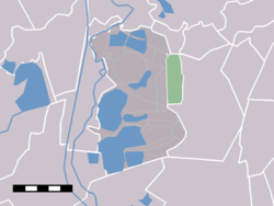 The statistical district of 's-Graveland in the municipality of Wijdemeren. | |
| Coordinates: 52°14′39″N 5°7′16″E / 52.24417°N 5.12111°ECoordinates: 52°14′39″N 5°7′16″E / 52.24417°N 5.12111°E | |
| Country | Netherlands |
| Province | North Holland |
| Municipality | Wijdemeren |
| Population (2004)[1] | |
| • Total | 1,250 |
| Time zone | UTC+01:00 (CET) |
| • Summer (DST) | UTC+02:00 (CEST) |

's-Graveland is a village in the Dutch province of North Holland. It is a part of the municipality of Wijdemeren, and lies about 4 km northwest of Hilversum. The former municipality of 's-Graveland merged with Loosdrecht and Nederhorst den Berg on 1 January 2002 to form the new municipality Wijdemeren.
The statistical district "'s-Graveland", which covers the village and the surrounding countryside, has a population of around 1180.[2]
Estates[]
Since the seventeenth century,'s-Graveland was a popular location for wealthy families from Amsterdam, who bought, built or inherited villas and estates there, like:
- Bantam,
- Boekesteyn,
- Gooilust,
- Hilverbeek aan de Leeuwenlaan,
- Land en Bosch,
- Schaep en Burgh,
- Schoonoord,
- Spanderswoud,
- Sperwershof,
- Spiegelrust,
- Swaenenburgh,
- Trompenburgh, built by Cornelis Tromp, in loan by the Rijksmuseum in Amsterdam.
The 's-Gravelandsevaart or 's-Gravelands canal ('vaart' is a passage for boats, 'varen' means to sail in Dutch), where most of the homes were built, used to be a major connection between Amsterdam and Hilversum. Transport per ship was often preferred over carriage, because the roads were not paved.
In the year 1672 the French caused a lot of damage, destroying homes and killing inhabitants. In 1673 the French abandoned the area again, and many homes were rebuilt, new gardens were added in French fashion.
Notable people[]
- Gustav Leonhardt (1928–2012), Dutch keyboard player, conductor, musicologist, teacher and editor
- Tjalling Koopmans (1910–1985), Dutch-American mathematician and economist and winner of the 1975 Nobel Memorial Prize in Economic Sciences
References[]
- ^ CBS, Kerncijfers postcodegebieden 2004 : postcodegebied 1243.
- ^ Statistics Netherlands (CBS), Statline: Kerncijfers wijken en buurten 2003-2005 [1]. As of 1 January 2005. Archived April 27, 1999, at the Wayback Machine
External links[]
- J. Kuyper, Gemeente Atlas van Nederland, 1865-1870, "'s-Graveland". Map of the former municipality, around 1868.
| Wikimedia Commons has media related to 's-Graveland (Noord Holland). |
| Authority control |
|
|---|
This North Holland location article is a stub. You can help Wikipedia by . |
- Populated places in North Holland
- Former municipalities of North Holland
- Wijdemeren
- North Holland geography stubs