't Woud
't Woud | |
|---|---|
Village | |
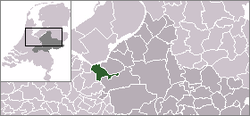 | |
 The village (dark red) and the statistical district (light green) of 't Woud in the municipality of Nijkerk. | |
| Coordinates: 52°12′N 5°33′E / 52.200°N 5.550°ECoordinates: 52°12′N 5°33′E / 52.200°N 5.550°E | |
| Country | Netherlands |
| Province | Gelderland |
| Municipality | Nijkerk |
| Population | |
| • Total | 1,700 |
| Time zone | UTC+1 (CET) |
| • Summer (DST) | UTC+2 (CEST) |

't Woud is a village in the Dutch province of Gelderland. It is a part of the municipality of Nijkerk, and lies about 12 km east of Amersfoort.
't Woud was founded by farmers at the beginning of the 20th century. After they had made the soil ready for farming they expanded their operations for decades. Nowadays only a few large farming companies are left. The other inhabitants are merely people who love living on the countryside.
The statistical area "'t Woud", which also can include the surrounding countryside, has a population of around 1790.[1]
References[]
- ^ Statistics Netherlands (CBS), Statline: Kerncijfers wijken en buurten 2003-2005. As of 1 January 2005. Archived July 24, 2006, at WebCite
This Gelderland location article is a stub. You can help Wikipedia by . |
Categories:
- Populated places in Gelderland
- Nijkerk
- Gelderland geography stubs