Ägerisee
| Ägerisee | |
|---|---|
| Lake Ägeri | |
 Ägerisee at Morgarten | |
 Ägerisee | |
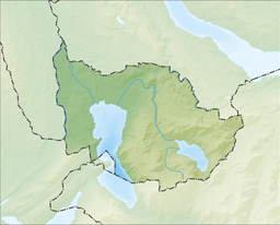
| Location | Canton of Zug |
| Coordinates | 47°7′12″N 8°36′58″E / 47.12000°N 8.61611°ECoordinates: 47°7′12″N 8°36′58″E / 47.12000°N 8.61611°E |
| Lake type | Glacial lake |
| Primary inflows | Hüribach |
| Primary outflows | Lorze |
| Catchment area | 4.068 km2 (1.571 sq mi) |
| Basin countries | Switzerland |
| Max. length | 5.4 km (3.4 mi) |
| Max. width | 1.4 km (0.87 mi) |
| Surface area | 7.3 km2 (2.8 sq mi) |
| Average depth | 49 m (161 ft) |
| Max. depth | 83 m (272 ft) |
| Water volume | 0.36 km3 (0.086 cu mi) |
| Residence time | 6.8 years |
| Surface elevation | 724 m (2,375 ft) |
| Frozen | January/February in some winters |
| Settlements | Oberägeri, Unterägeri |


Ägerisee or Lake Aegeri is a glacial lake in the Canton of Zug, Switzerland. The two municipalities along its shore are Oberägeri and Unterägeri. The main tributary is the Hüribach; the Lorze river drains the Ägerisee. Since 1992 the lake has been used as a water reservoir.
The Battle of Morgarten took place in 1315 on the shores of the Ägerisee.

See also[]
External links[]
![]() Media related to Lake Ägeri at Wikimedia Commons
Media related to Lake Ägeri at Wikimedia Commons
- Ägerisee in German, French and Italian in the online Historical Dictionary of Switzerland.
- Waterlevels at Unterägeri from the Swiss Federal Office for the Environment
| hide Authority control | |
|---|---|
| General | |
| Other | |
This Canton of Zug location article is a stub. You can help Wikipedia by . |
Categories:
- Lakes of Switzerland
- Lakes of the canton of Zug
- Reuss basin
- Glacial lakes
- Switzerland geography stubs