Île Longue (Kerguelen Islands)
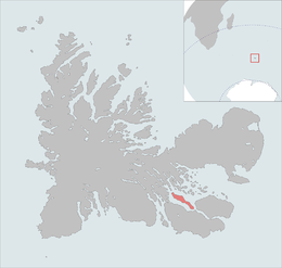 The île Longue is highlighted on this Kerguelen Islands map. | |
| Geography | |
|---|---|
| Location | Indian Ocean |
| Coordinates | 49°32′S 69°54′E / 49.533°S 69.900°ECoordinates: 49°32′S 69°54′E / 49.533°S 69.900°E |
| Archipelago | Îles Kerguelen |
| Area | 35.0 km2 (13.5 sq mi) |
| Highest elevation | 270 m (890 ft) |
| Highest point | Pic d'Antoine |
| Administration | |
| District | Îles Kerguelen |
| Demographics | |
| Population | 0 |

Île Longue is one of the Kerguelen Islands situated near to the south-east coast of Grande Terre, the principal island.
The highest point is a mountain named Pic d'Antoine, at 270 metres.
Since 1950 the islands hosts about 3500 free range sheep bred in order to provide fresh meat to the Port-aux-Français settlement.[1]
References[]
- Kerguelen islands map, Géoportail IGN.
- General view of non-metropolitan France, Maison de la Géographie.
This French Southern Territories location article is a stub. You can help Wikipedia by . |
Categories:
- Uninhabited islands of the Kerguelen Islands
- Non-metropolitan France geography stubs
- Subantarctic island geography stubs