Österlen

Österlen (Swedish pronunciation: [œstɛˈɭeːn])[1] (Danish: Østerlen) is a region in the southeast of the Swedish province of Scania (Skåne).[2]
The area is a tourist destination known for its natural environment, historic buildings, fishing hamlets, small towns and farmland.[3]
History[]
The name derives from its location 'the way eastwards' (ancient route from Ystad, heading north-east); (len is short for leden, i.e. route).In the past, the area west of Ystad was called "Västerlen" (the way westwards) but that term is no longer in use. In the 17th century, when Österlen and the whole of Scania (Skåne) were Danish, the Österlen area was called 'Östreslätt', which means 'the eastern plains' and comprised the area from Ystad to Simrishamn and probably the lands northwards until the woodland belt began. We have no 17th-century evidence of the usage of the word 'Österlen' as of today. The descriptive term Österlen is associated with the writings of Nils Lovén (1796–1858) who was a clergyman and university professor as well as an author and the ethnologist Nils Gustaf Bruzelius who claimed that it was a well-known fact that people from Österlen and people from Västerlen were always at loggerheads and were of very different natures. Bruzelius also considered the usage of the term "Österlen" as "ancient."[4].[5] [6]
Use of the term Österlen was popularized during the 1920s by author Fritiof Nilsson Piraten (1895–1972), poet Pehr Theodor Tufvesson (1884–1947) and newspaper journalist John Oskar Osterman (1871–1942). Many songs and poems have been written about Österlen. One of the most popular songs is Om himlen och Österlen, composed by Scanian singer-songwriter Michael Saxell. [7][8] [9]
Österlen was defined in 1929 as including Albo härad, Ingelstad härad and Järrestad härad in the southeastern part of the Scania. Today the term is associated with Tomelilla Municipality, Ystad Municipality and Simrishamn Municipality. Österlen encompasses the cities of Simrishamn and Tomelilla as well as including Stenshuvud National Park.[10] The map that is published here is not historically correct in that Ingelstad härad/hundred included all the territory to the city of Ystad itself. There were temporary redrawings of this and other borders but from the beginning of the hundred system, Ingelstad went to the city of Ystad, and locations like Nybro and Köpinge are included in our first descriptions of Österlen.
Historical buildings and places[]
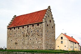
Historical buildings in Österlen include the medieval castle Glimmingehus, St. Nicholas Church in Simrishamn, known since the 12th century, and the medieval St. Olof Church. Ale's Stones near Kåseberga on the south coast and The King's Grave in Kivik are ancient historical monuments.[11]
Cultural events and festivals[]
Cultural events and festivals such as the arts exhibition Konstrundan and the apple market in Kivik are arranged every year.[3]
Gallery[]
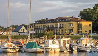
Hotell Svea

Sankt Nicolai kyrka in Simrishamn

Simrishamn harbour
Kåseberga harbour
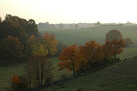
Brösarps backar

Forsemölla near Rörum

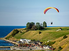
East coast beach

Stortorget in Tomelilla


References[]
- ^ Jöran Sahlgren; Gösta Bergman (1979). Svenska ortnamn med uttalsuppgifter (in Swedish). p. 30.
- ^ "Österlen". Visit Skåne. Retrieved December 1, 2018.
- ^ a b Southeast Visit Skåne
- ^ Allmogelifwet i Ingelstads härad i Skåne under slutet af förra och början af detta århundrade: kulturbild, Malmö 1876
- ^ "Wallander's Ystad". visitsweden.com. Retrieved December 1, 2018.
- ^ Åke K G Lundquist. "Nils Lovén". Svenskt biografiskt lexikon. Retrieved December 1, 2018.
- ^ "Om Piraten". piratensallskapet.se. Retrieved December 1, 2018.
- ^ Svensk biografisk handbok. "Tufvesson, Pehr Theodor". Retrieved December 1, 2018.
- ^ roxetteblog.com. "Michael Saxell – a man behind Christoffer Lundquist's album". Retrieved December 1, 2018.
- ^ "Stenshuvud National Park". naturvardsverket.se. Archived from the original on April 4, 2009. Retrieved December 1, 2018.
- ^ History About Österlen
External links[]
| Wikivoyage has a travel guide for Österlen. |
| Wikimedia Commons has media related to Österlen. |
Coordinates: 55°37′35″N 14°11′05″E / 55.626445°N 14.184723°E

| Authority control |
|---|
This article about a location in Skåne County, Sweden is a stub. You can help Wikipedia by . |
- Geography of Skåne County
- Skåne County geography stubs