Überherrn
Überherrn | |
|---|---|
 Church of Saint Matthew in Altforweiler | |
 Coat of arms | |
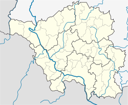
show Location of Überherrn within Saarlouis district | |
 Überherrn | |
| Coordinates: 49°15′N 6°42′E / 49.250°N 6.700°ECoordinates: 49°15′N 6°42′E / 49.250°N 6.700°E | |
| Country | Germany |
| State | Saarland |
| District | Saarlouis |
| Subdivisions | 6 |
| Government | |
| • Mayor (2019–24) | Annelie Yliniva-Hoffmann[1] (SPD) |
| Area | |
| • Total | 34.31 km2 (13.25 sq mi) |
| Highest elevation | 377 m (1,237 ft) |
| Lowest elevation | 192 m (630 ft) |
| Population (2020-12-31)[2] | |
| • Total | 11,373 |
| • Density | 330/km2 (860/sq mi) |
| Time zone | UTC+01:00 (CET) |
| • Summer (DST) | UTC+02:00 (CEST) |
| Postal codes | 66799–66802 |
| Dialling codes | 06836, 06837 |
| Vehicle registration | SLS |
| Website | ueberherrn.de |
show This article may be expanded with text translated from the corresponding article in German. (April 2021) Click [show] for important translation instructions. |
Überherrn is a municipality in the district of Saarlouis, in Saarland, Germany. It is situated along the river Bist on the border with France, approx. 10 km (6.21 mi) southwest of Saarlouis, and 20 km (12.43 mi) west of Saarbrücken. It has 12,150 inhabitants. At the part Felsberg-Berus, there is the Longwave transmitter Europe 1.
References[]
- ^ Gewählte Ober-/Bürgermeister*innen, Landrät*innen und Regionalverbandsdirektor*in im Saarland, accessed 18 June 2021.
- ^ "Saarland.de – Amtliche Einwohnerzahlen Stand 31. Dezember 2020" (PDF). Statistisches Amt des Saarlandes (in German). June 2021.
Categories:
- Municipalities in Saarland
- Saarlouis (district)
- Saarland geography stubs


