Črni Potok, Šmartno pri Litiji
Črni Potok | |
|---|---|
 | |
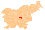
 Črni Potok Location in Slovenia | |
| Coordinates: 46°2′3.99″N 14°50′35.38″E / 46.0344417°N 14.8431611°ECoordinates: 46°2′3.99″N 14°50′35.38″E / 46.0344417°N 14.8431611°E | |
| Country | |
| Traditional region | Lower Carniola |
| Statistical region | Central Slovenia |
| Municipality | Šmartno pri Litiji |
| Area | |
| • Total | 2.83 km2 (1.09 sq mi) |
| Elevation | 259.7 m (852.0 ft) |
| Population (2002) | |
| • Total | 130 |
| [1] | |

Črni Potok (pronounced [ˈtʃəɾni ˈpɔːtɔk]; German: Schwarzenbach[2]) is a dispersed settlement in the valley of (Slovene: Črni potok) south of Šmartno pri Litiji in central Slovenia. The area is part of the historical region of Lower Carniola. The entire Municipality of Šmartno pri Litiji is now included in the Central Slovenia Statistical Region.[3] It includes the hamlets of Brezje (formerly Sveti Križ, German: Heiligenkreuz[2]) and Sela.[4]
The local church, built on a small hill in the southwestern hamlet of Brezje, is dedicated to the Exaltation of the Holy Cross (Slovene: Povišanje svetega Križa) and belongs to the Parish of Šmartno. It dates to the 17th century.[5]
References[]
- ^ Statistical Office of the Republic of Slovenia
- ^ Jump up to: a b Leksikon občin kraljestev in dežel zastopanih v državnem zboru, vol. 6: Kranjsko. 1906. Vienna: C. Kr. Dvorna in Državna Tiskarna, pp. 94–95.
- ^ Šmartno pri Litiji municipal site
- ^ Savnik, Roman, ed. 1971. Krajevni leksikon Slovenije, vol. 2. Ljubljana: Državna založba Slovenije, pp. 259–260.
- ^ "EŠD 2548". Registry of Immovable Cultural Heritage (in Slovenian). Ministry of Culture of the Republic of Slovenia. Retrieved 5 September 2011.
External links[]
- Črni Potok at Geopedia
 Media related to Črni Potok, Šmartno pri Litiji at Wikimedia Commons
| hide | ||
|---|---|---|
| Settlements | Administrative seat: Šmartno pri Litiji
|  |
| Landmarks | ||
| Notable people | ||
This article about the Municipality of Šmartno pri Litiji in Slovenia is a stub. You can help Wikipedia by . |
- Populated places in the Municipality of Šmartno pri Litiji
- Osrednjeslovenska statistical region geography stubs