1946 Valais earthquake
 | |
 | |
| UTC time | 1946-01-25 17:31:50 |
|---|---|
| ISC event | 898227 |
| USGS-ANSS | n/a |
| Local date | 25 January 1946 |
| Local time | 17:32 CET |
| Magnitude | Mw 5.8–6.1 |
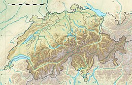
| Epicenter | 46°24′N 7°30′E / 46.4°N 7.5°ECoordinates: 46°24′N 7°30′E / 46.4°N 7.5°E |
| Max. intensity | VIII (Severe) |
| Aftershocks | Three recorded. The largest was a 5.5–6.0 Mw |
| Casualties | 3 dead in Switerland 1 dead in France |

The 1946 Valais earthquake struck on January 25 at 17:32 local time with an eicenter region in Sierre, the capital city of Valais, a canton in Switzerland. The earthquake had an estimated moment magnitude of 5.8 to 6.1 Mw and a maximum Modified Mercalli intensity of VIII (Severe).[1][2]
Earthquake[]
The earthquake immediately disrupted the supply of power in Sierre, and other nearby populated centers in the Valais canton. The tremors caused panic and drove residents out of their homes. Many homes suffered damage to their structure, with chimneys destroyed, detached roof tiles, and broken facades. A newly-constructed church in Chippis partially collapsed and had some of the remaining structures severely damaged and unstable. Desite the severity of damage, with 3,500 buildings damaged, there were very few injuries or deaths reported; three persons suffered fatal shocks and another was crushed to death by a car in Aix-les-Bains, France.[3] Twenty-one rockfalls, one major, occurred. The earthquake also triggered 11 landslides, four avalanches, and a number of ground effects along the Rhône river valley. The landslides and rockfalls reportedly destroyed huts and barns near the mountainside. Damage was also reported in the district of Vaud in Villeneuve. In Château-d'Œx, the quake knocked dispay items onto the ground at an art exhibition.[4] The total damage is estimated at 5.265 million Swiss francs in 1946, or 25.7 million in 2021.[5]
Foreshocks and aftershocks[]
Three large aftershocks were recorded up till May 1946. The first two measured 5.2 and 5.1 on January 26 and February 4 were assigned maximum intenities VI to V. The largest occurred on May 30 with a magnitude of Mw 5.5–6.0 and maximum intensity of VII. The aftershock on May 30 triggered 22 rockfalls and three landslides.[6]
Prior to the mainshock, two notable foreshocks occurred on November 10 and 13 with respective intensities V and IV on the Rossi-Forel scale.
See also[]
References[]
- ^ "Earthquake Catalog of Switzerland 2009". ecos09.seismo.ethz.ch. Swiss Seismological Service. Retrieved 2 September 2021.
- ^ Swiss Seismological Service (2002). "Earthquake Catalog of Switzerland 2002". Zürich, Switzerland: Italian Macroseismic Historical Archive. Retrieved 2 September 2021.
- ^ "Sierre 1946". seismo.ethz.ch. Swiss Seismological Service. Retrieved 2 September 2021.
- ^ "Vor 75 Jahren erschütterte ein gewaltiges Erdbeben das Wallis". Telebasel Report (in German). 25 January 2021. Retrieved 2 September 2021.
- ^ Stefan Fritsche; Donat Fäh (2009). "The 1946 magnitude 6.1 earthquake in the Valais: site-effects as contributor to the damage" (PDF). Swiss Journal of Geosciences. 102 (423): 423-439. doi:10.1007/s00015-009-1340-2. hdl:20.500.11850/21268.
- ^ Stefan Fritsche; Donat Fäh; Gabriela Schwarz-Zanetti (2012). "Historical intensity VIII earthquakes along the Rhone valley (Valais, Switzerland): primary and secondary effects". Swiss Journal of Geosciences. Springer. 105: 1–18. doi:10.1007/s00015-012-0095-3. hdl:20.500.11850/61304.
- 1946 earthquakes
- Earthquakes in Switzerland
- 1946 in Switzerland
- History of Valais
- Sierre
- Earthquakes in France
- Savoie
- Aix-les-Bains
- 1940s disasters in Europe