2014–15 eruption of Fogo
| 2014–15 eruption of Fogo | |
|---|---|
 Satellite map of the eruption of Fogo with its volcanic clouds that headed south on December 2, 2014 | |
| Volcano | Pico do Fogo |
| Start date | November 23, 2014 |
| End date | February 8, 2015 |
| Location | Fogo, Cape Verde |
| VEI | 3 |
The 2014–15 eruption of Fogo began on 23 November 2014, continuing until 8 February 2015. It was the first eruption of Pico do Fogo in 19 years, and the longest since its 1857 eruption. It had a Volcanic Explosivity Index of 3, making it the largest eruption of the volcano since records began.[1]
It caused an estimated five billion escudos (€45.3 million) in damages.[2]
Volcanic activity[]
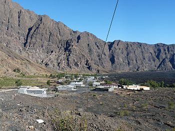

The volcano started erupting shortly after 10 a.m. on Sunday, 23 November 2014.[3] There had been a few days of heightened seismic activity, with stronger tremors occurring the night before the eruption started.[3] The eruption began at Pico Pequeno and at another location near the crater made by the 1995 eruption. The population of Chã das Caldeiras, totaling around 1,000 inhabitants, spent the night outside their homes due to the strong earthquakes,[3] and started being evacuated when the eruption began. As in 1995, some people initially refused to abandon their homes, but eventually heeded the authorities' instructions.
On November 27, a lava flow moved northward toward the village center.[4] During the first days of eruption, a 3.5 km stretch of the southern basalt paved road that connected São Filipe was covered with lava. On December 1, the lava flow rate was 15 meters an hour and it had engulfed 400 ha of land, destroyed 18 houses and was nearing the village center.[5] A day later, lava entered into Portela where 50 houses were destroyed along with a school and a hotel.[6] By December 7, much of Portela was ruined and 70% of Bangaeira had been damaged.[7] On December 9, lava reached more areas inside the Bordeira and Bangaeira and by December 12 it affected almost all of Bangaeira.[citation needed]
References[]
- ^ Eruptive history of Mount Fogo at the Smithsonian Global Volcanism Program
- ^ "Prejuízos de 45,3 milhões de euros com vulcão do Fogo". www.jn.pt (in Portuguese). Retrieved 2021-02-25.
- ^ Jump up to: a b c "Volcano of Fogo in Eruption". Oceanpress. 23 November 2014. Archived from the original on 2014-11-23.
- ^ "Erupção vulcânica: Fogo: Reabertura de frente sul diminui impacto sobre Portela". Fogonews (in Portuguese). 28 November 2014. Archived from the original on 5 December 2014. Retrieved 28 November 2014.
- ^ "Erupção vulcânica: Lavas avançam a 15 metros/h e engoliram mais três casas durante a noite" [Volcanic Eruption: Lavas Flowed 15 m/h and Engulfed Three More Houses During the Night]. Fogonews (in Portuguese). 1 December 2014. Archived from the original on 2 March 2018. Retrieved 1 December 2014.
- ^ "Lava engole Escola, Hotel Pedra Brabo e algumas casas" [Lava Engulfed a School, Hotel Pedra Brabo and Other Buildings]. A Semana (in Portuguese). 2 December 2014. Archived from the original on 5 December 2014. Retrieved 2 December 2014.
- ^ "Lava do vulcão do Fogo destruiu Portela e invadiu 70% de Bangaeira" [Lava From the Fogo Volcano Destroyed Portela and Affected 70% of Bangaeira]. Fogo News (in Portuguese). 7 December 2014. Archived from the original on 9 December 2014. Retrieved 7 December 2014.
External links[]
- Fogo Summary at Smithsonian Global Volcanism Program including the 2014–15 eruption
| hide The island of Fogo | ||
|---|---|---|
| Mosteiros |  | |
| Santa Catarina do Fogo | ||
| São Filipe | ||
| Other geographical features | ||
| Transportation | ||
| Other topics | ||
- Fogo, Cape Verde
- History of Cape Verde
- 21st-century volcanic events
- 2014 natural disasters
- 2014 in Cape Verde
- November 2014 events in Africa
- December 2014 events in Africa
- 2015 natural disasters
- 2015 in Cape Verde
- January 2015 events in Africa
- February 2015 events in Africa
- VEI-3 eruptions
- Volcanic eruptions in Cape Verde