340 on the Park
| 340 on the Park | |
|---|---|
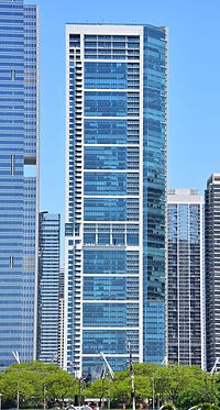 View from Millennium Park May, 2016 | |
 | |
| General information | |
| Type | Residential |
| Location | 340 East Randolph St Chicago, Illinois |
| Construction started | 2005 |
| Completed | 2007 |
| Height | |
| Roof | 205 m (673 ft) |
| Top floor | 192.4 m (631 ft) |
| Technical details | |
| Floor count | 62[1] |
| Design and construction | |
| Architect | Solomon Cordwell Buenz & Associates |
| Developer | Magellan Development Group & [2] |
| Structural engineer | Magnusson Klemencic Associates |
340 on the Park is a residential tower in the Lakeshore East development of the neighborhood of New Eastside/ East Loop Chicago and was completed in 2007. The building briefly surpassed 55 East Erie as the tallest all-residential building in Chicago. It is the second-tallest all-residential building in Chicago (One Museum Park is the current tallest) at 672 feet (205 meters) with 62 floors.
The architectural firm Solomon Cordwell Buenz designed the tower and it was built by Magellan Development. The structural engineering firm Magnusson Klemencic Associates designed the building using post-tensioning in order increase the floor-to-ceiling heights. James McHugh Construction Co installed post-tensioning tendons supplied by Amsysco Inc.[3]
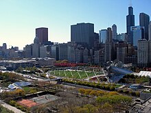
The tower is located in the Lakeshore East complex which, when completed, will house thousands of residents. 340 on the Park is set flush next to Randolph Street, allowing unobstructed views of Millennium Park, Grant Park, The Park at Lakeshore East and Lake Michigan. The tower's design also allows for nearby buildings to maintain some views of the park.
340 on the Park has also become the first residential tower in the Midwestern United States to achieve Silver LEED certification for its "green" design,[4] including a large winter garden for residents. Additional benefits include a connection to the Chicago Pedway system, low-flow water fixtures for both residential and public spaces, and energy-efficient fixtures such as lights and mechanical equipment.
The north side of the building is contoured so that views from The Buckingham next to the building are not interfered with.

Education[]
Residents of 340 on the Park are zoned to schools in the Chicago Public Schools.
See also[]
- List of buildings
- List of skyscrapers
- List of tallest buildings in Chicago
- List of tallest buildings in the United States
- World's tallest structures
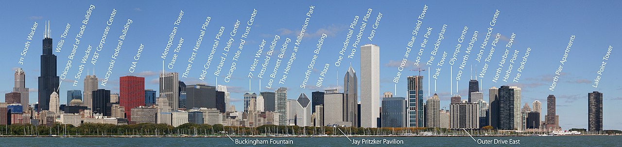
Position in Chicago's skyline[]
References[]
- ^ "Archived copy". Archived from the original on April 7, 2012. Retrieved November 16, 2006.CS1 maint: archived copy as title (link)
- ^ Sharoff, Robert (June 4, 2006). "How a Park Changed a Chicago Neighborhood". The New York Times. Retrieved March 17, 2019.
- ^ "Reports". www.construction.com. February 8, 2017. Retrieved March 17, 2019.
- ^ "Newcityskyline - 340 On the Park breaking records". September 28, 2007. Archived from the original on September 28, 2007. Retrieved March 17, 2019.
- ^ "Williams Wells High School". October 11, 2006. Archived from the original on October 11, 2006. Retrieved March 17, 2019.
External links[]
| Wikimedia Commons has media related to 340 on the Park. |
Coordinates: 41°53′5.43″N 87°37′8″W / 41.8848417°N 87.61889°W

- Residential condominiums in Chicago
- Residential skyscrapers in Chicago
- Leadership in Energy and Environmental Design basic silver certified buildings
- Residential buildings completed in 2007
- New Eastside
- Lakeshore East
- 2007 establishments in Illinois