36th Street Portal
36th Street Portal | |||||||||||
|---|---|---|---|---|---|---|---|---|---|---|---|
 A Route 10 trolley emerges from the 36th Street portal. | |||||||||||
| Location | 36th & Ludlow Streets, Philadelphia, Pennsylvania | ||||||||||
| Coordinates | 39°57′22″N 75°11′38″W / 39.956022°N 75.193911°WCoordinates: 39°57′22″N 75°11′38″W / 39.956022°N 75.193911°W | ||||||||||
| Owned by | SEPTA | ||||||||||
| Platforms | Sidewalk with open shelter | ||||||||||
| Tracks | 2 | ||||||||||
| History | |||||||||||
| Opened | October 17, 1955[1] | ||||||||||
| Electrified | Overhead lines | ||||||||||
| Services | |||||||||||
| |||||||||||
| Location | |||||||||||
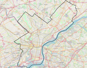 36th Street Portal Location within Philadelphia | |||||||||||

The 36th Street Portal is a SEPTA subway–surface lines trolley station in Philadelphia serving Route 10.[2] The station is located at the corner of 36th and Ludlow streets, one block from Market Street. The station is located at a tunnel portal that connects with trackage for the other subway–surface lines.
The station is two blocks north of 36th Street station, an underground station serving the remaining subway–surface routes.
History[]
The portal station was opened in October 17 1955 [3] by the Philadelphia Transportation Company (PTC) as part of a larger project to move portions of the elevated Market Street Line and surface trolleys underground.[4] The original project to bury the elevated tracks between 23rd to 46th streets was announced by the PTC's predecessor, the Philadelphia Rapid Transit Company (PRT), in the 1920s, but was delayed due to the Great Depression and World War II.[5] The PTC's revised project also included a new tunnel for subway–surface trolleys underneath the campus of the University of Pennsylvania, continuing from the original western portal at 23rd and Market streets to the 36th Street Portal, as well as to 40th Street and Baltimore Avenue for other trolley routes besides the 10.[5]
However, service to the vicinity of 36th and Market streets has existed long before then, as the Route 10 was established in its original form by the PRT in 1906.[2]

Station layout[]
West of the station, Route 10 runs on surface streets through West Philadelphia to the Overbrook section of the city.[2] East of the station, trolleys enter the tunnel and continue to Center City Philadelphia.
| Side platform | |
| Westbound | ← Route 10 toward 63rd & Malvern (36th & Market) |
| Eastbound | Route 10 toward 13th Street (33rd Street) → |
| Side platform | |
References[]
- ^ Springirth, Kenneth C. (2008). Southeastern Pennsylvania Trolleys. ISBN 9780738556925.
- ^ a b c ISEPTAPHILLY Blog. "Route of the Week - 10". SEPTA. Retrieved June 2, 2020.
- ^ Springirth, Kenneth C. (2008). Southeastern Pennsylvania Trolleys. ISBN 9780738556925.
- ^ Puckett, John L. and Mark Frazier Lloyd. Becoming Penn: The Pragmatic American University, 1950-2000, p. 35, at Google Books, accessed May 31, 2020.
- ^ a b John L. Puckett. "Putting the Market Street Elevated Underground". West Philadelphia Collaborative History. University of Pennsylvania Graduate School of Education. Retrieved June 2, 2020.
External links[]
 Media related to 36th Street Portal (SEPTA station) at Wikimedia Commons
- SEPTA Route 10 map
- Flickr - SEPTA 36th Street Portal images
- Station from Google Maps Street View
- SEPTA Subway–Surface Trolley Line stations
- Railway stations in Philadelphia
- Railway stations in the United States opened in 1955
- 1955 establishments in Pennsylvania