A32 road
 | |
|---|---|
 | |
| Route information | |
| Length | 29.2 mi (47.0 km) |
| Major junctions | |
| South end | Gosport 50°47′39″N 1°07′07″W / 50.7942°N 1.1187°W |
| A27 A31 | |
| North end | Alton 51°07′54″N 0°59′40″W / 51.1318°N 0.9944°W |
| Location | |
| Primary destinations | Fareham |
| Road network | |

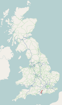
The A32 is a road in Hampshire, southern England, that links Gosport and Alton. Starting at Gosport, facing Portsmouth, it travels north via Fareham, Wickham, Droxford, before joining the A31 road near Alton. The road is 29.2 miles (47.0 km) long from the seafront at Gosport to the roundabout with the A31 near Alton, and has entirely non-primary status.[1]
Despite its non-primary status, the road forms the main access to the town of Gosport. At rush-hour times, the road is often extremely congested (northbound in the morning rush, southbound in the evenings) as commuters head through central Fareham from the Gosport peninsula to the M27.
The main pinch-point is the 1-mile (1.6 km) long section of road between the Newgate Lane Flyover (junction B3334) and the Quay Street Roundabout in central Fareham where traffic delays often cause northbound tailbacks of 3 miles (4.8 km) at peak times. During the evening rush, traffic can at times back up to the M27 at Junction 11 and along the slow lane (Lane One) of the motorway.[2]
There have for many years been plans to provide a light rail solution to the traffic problem by utilising the former Gosport to Fareham railway line but this was scrapped in 2005. Part of the former railway line has since been converted for "Eclipse" bus rapid transit routes.[3]
The A32 is a popular route for motorcyclists, particularly at weekends; the cafe ( now Loomies, formerly a "Little Chef") where the A272 crosses the A32 at West Meon has become central meeting place for many groups of riders. The historic site of Fort Widley to the south is easily accessed from Wickham and is a popular route for motorcyclists.[4]
The A32 is referenced in a children's song.[5]
External links[]
References[]
- ^ "Ordnance Survey 1:250,000 map". Ordnance Survey. Retrieved 20 December 2011.
- ^ "North of Fareham Strategic Development Area". Fareham Borough Council. Archived from the original on 27 November 2011. Retrieved 20 December 2011.
- ^ "Eclipse | Portsmouth, Fareham & Gosport | First Bus".
- ^ "Bike Social's Top Routes!". Bennetts UK. Retrieved 27 February 2017.
- ^ "Trouble for Hugh the Hedgehog (song by Nick Cope )". Archived from the original on 21 December 2021.
A roads in Zone 3 of the Great Britain road numbering scheme | ||
|---|---|---|
Coordinates: 50°58′17″N 1°07′54″W / 50.9714°N 1.1316°W
This England road or road transport-related article is a stub. You can help Wikipedia by . |
- Roads in England
- Transport in Hampshire
- England road stubs