Aalst, Buren
Aalst | |
|---|---|
Hamlet | |
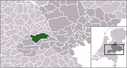 | |
 The hamlet (dark red) and the statistical district (light green) of Aalst in the municipality of Buren. | |
 Aalst Location in the Netherlands | |
| Coordinates: 51°56′03″N 5°32′25″E / 51.93417°N 5.54028°ECoordinates: 51°56′03″N 5°32′25″E / 51.93417°N 5.54028°E | |
| Country | Netherlands |
| Province | Gelderland |
| Municipality | Buren |
| Time zone | UTC+1 (CET) |
| • Summer (DST) | UTC+2 (CEST) |


Aalst is a hamlet in the Dutch province of Gelderland. It is a part of the municipality of Buren, and lies about 10 km southwest of Wageningen.
The statistical area "Aalst", which contains the hamlet Aalst, the farmland to the southwest, and the smaller hamlets and Hoogmeien, has a population of around 1060.[1]
Between 1811 and 1998, Aalst belonged to the municipality of Lienden. In the middle of the 19th century, the population of Aalst was 150; there was a nice mansion called "Kolvenschoten" located here.[2]
References[]
- ^ Statistics Netherlands, 2007. Figures are for the year 2006. Statistics are available in Google Earth format.
- ^ Abraham Jacob van der Aa, "Aardrijkskundig woordenboek der Nederlanden", vol. 1 (A), 1839, p. 15.
| hide Authority control | |
|---|---|
| General | |
| National libraries | |
This Gelderland location article is a stub. You can help Wikipedia by . |
Categories:
- Populated places in Gelderland
- Buren
- Gelderland geography stubs