Aboud
Aboud | |
|---|---|
Municipality type D (Village council) | |
| Arabic transcription(s) | |
| • Arabic | عابود |
| • Latin | 'Abud (official) Abboud (unofficial) |
 Aboud from the south | |
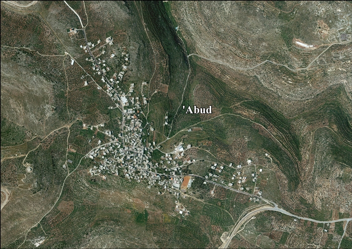
 Aboud Location of Aboud within Palestine | |
| Coordinates: 32°00′54″N 35°04′05″E / 32.01500°N 35.06806°ECoordinates: 32°00′54″N 35°04′05″E / 32.01500°N 35.06806°E | |
| Palestine grid | 156/158 |
| State | State of Palestine |
| Governorate | Ramallah and al-Bireh |
| Government | |
| • Type | Village council |
| • Head of Municipality | Elias Azar |
| Area | |
| • Total | 15,000 dunams (15.0 km2 or 5.8 sq mi) |
| Population (2007) | |
| • Total | 2,084 |
| • Density | 140/km2 (360/sq mi) |
| Name meaning | Abud, personal name, from "to worship"[1] |

Aboud (Arabic: عابود, ʿĀbūd) is a Palestinian village in the Ramallah and al-Bireh Governorate in the central West Bank, Palestinian territories, northwest of Ramallah and 30 kilometers north of Jerusalem. Nearby towns include al-Lubban to the northeast and Bani Zeid to the northwest.
According to the Palestinian Central Bureau of Statistics, the village had a population of approximately 2,084 inhabitants in 2007.[2] It has a mixed population of Muslims and Christians, mostly Eastern Orthodox. Near the village are numerous natural springs, which are sources for the Yarkon River.
Location[]
Abud is located 17.7 km northwest of Ramallah. It is bordered by Deir Nidham to the east, Bani Zeid to the north, Rantis and al Lubban el Gharbi to the west, and Deir Abu Mash'al to the south.[3]
History[]
Sherds from the Iron Age II, Byzantine, Crusader/Ayyubid and Mamluk eras have been found.[4]
There is archeological evidence that the village was inhabited during the Roman, Byzantine, Crusader, Ayyubid, Mamluk and Ottoman eras.[5]
Medieval era[]
During Fatimid, in 1030, a Christian monk from Aboud named Elias copied Syriac manuscripts in Antioch. He later returned to Aboud and founded the Deir al-Kaukab monastery near the village.[6] A Palestinian Syriac inscription in the St. Mary Church in Aboud indicate that the church existed in the village by at least 1058, also during Fatimid rule.[7]
In 1099, Aboud and much of Syria was conquered by European Crusaders. During the Crusader period, Aboud was known by them as the Latin Casale Santa Maria. At the time, it was an unfortified agricultural village inhabited mostly by local Orthodox Christians. A minority of the population consisted of Crusader settlers.[7] The Crusaders made improvements and additions to the church, such as the nave and the north aisle.[8]
In 1104, Mufarij ibn Abu al-Hayr al-Abudi, a monk from Aboud, copied Syriac manuscripts in the Saint Catherine's Monastery in Sinai.[6] In 1167, Casale Santa Maria was sold by King Baldwin IV to the Knights Hospitallers. Starting in 1176, they used revenues from the village to supply white bread to the sick in the hospital of Jerusalem.[5]
In 1225, Yaqut al-Hamawi noted Aboud was a "small town in Filastin Province, near Jerusalem. The name is Hebrew, and [has] become Arabicized."[9] At another point in the 13th century, an Aboud monk, Sarur ibn Abd al-Masih al-Abudi, was recorded as copying Syriac manuscripts in Cairo.[6] The southern part of Aboud was founded in the 13th or 14th century, during Mamluk rule. Two ornate mausoleums in this part of Aboud were built during the Mamluk period.[10] Arab historian al-Maqrizi mentioned these in the 14th century.[5]
Ottoman era[]
Aboud as part of Palestine was incorporated into the Ottoman Empire. In the 1553–57 tax records, Aboud had a population of 35 families; 19 of whom were Christian and 16 Muslim.[10] In the 1596 Ottoman tax records, it was classified as part of the nahiya ("sub-district") of Ramla, part of the Sanjak of Gaza. Its population remained the same, with 19 Christian households and 16 Muslim households,[11] and the inhabitants paid a fixed tax rate of 25% on wheat, barley, and other produce; a total of 21,000 akçe. All of the revenue went to a waqf.[12] It was later designated as a part of the Bani Zeid administrative region, still under the Ottomans.[5][13]
In 1870 the French explorer Victor Guérin found that Aboud contained 800 inhabitants, half Greek Orthodox and half Muslims,[14] while an Ottoman village list of about the same year showed that Aboud had 225 Muslims with 69 houses, and 170 Greek Orthodox with 66 houses, though the population count included men only.[15][16]
In 1882, the PEF's Survey of Western Palestine described the village as "a large and flourishing Christian village, of stone, the houses nearly all marked with the Cross in red paint," with a population of 400 Orthodox Christians and 100 Muslims.[17]
In 1896 the population of Abud was estimated to be about 303 Muslims and 366 Christians.[18]
British Mandate era[]
In the 1922 census of Palestine conducted by the British Mandate authorities, Aboud had a population of 754; 352 Muslim and 402 Christians.[19] The latter included 335 Orthodox, 41 Roman Catholics, and 26 who belonged to the Church of England.[20] At the time of the 1931 census, the population had increased to 910; 470 Christians and 440 Muslims, in 215 houses.[21] The Christians largely inhabited the older, northern part of Aboud, while the Muslims inhabited the relatively newer, southern part.[10]
In the 1945 statistics, the population was 1,080; 550 Muslims and 530 Christians.[22] The total land area was 15,007 dunams, according to an official land and population survey.[23] Of this, 4,843 dunams were allocated for plantations and irrigable land, and 1,905 for cereals,[24] while 55 dunams were classified as built-up (urban) areas.[25]

Aboud ('Abud) 1944 1:20,000

Aboud ('Abud) 1945 1:250,000


Jordanian era[]
In the wake of the 1948 Arab–Israeli War, and after the 1949 Armistice Agreements, Aboud came under Jordanian rule. It was annexed by Jordan in 1950.
The Jordanian census of 1961 found 1,521 inhabitants,[26] of whom 716 were Christians.[27]
1967–present[]
Since the Six-Day War in 1967, Aboud has been under Israeli occupation. After Oslo II in 1995, 16.8% of village land was classified as Area B, and the remaining 83.2% as Area C. Israel has confiscated land from Aboud in order to construct the Israeli settlements of Beit Aryeh-Ofarim.[28] In late July 2018, Israeli authorities informed village elders that they intended seizing a further 324 dunums (80 acres) of land shared by both Aboud and Al-Lubban al-Gharbi on grounds that the land was needed in order to construct an Israeli-only road between the settlements of Beit Arye and Ofarim.[29]
Demographics[]
According to the Palestinian Central Bureau of Statistics, the village had a population of approximately 2,084 inhabitants in 2007.[2] It has a mixed population of Muslims and Christians, mostly Eastern Orthodox. It has ancient churches built during the Byzantine period of the 6th to 8th centuries.
Ancient churches[]
Adjacent to Aboud is an ancient monastery named after Saint Barbara. Located on a hill due west of the village, the Church of Saint Barbara was erected in the Byzantine period.[5] Archaeologists trace its history to the 6th century CE.[30] Ancient catacombs have been uncovered by the church; their dating is uncertain. One of the burial caves is especially grandiose, with a door post decorated with carvings of wreaths, grape vines and grape clusters standing at its entrance.[5]
Locals consider Saint Barbara to have been the oldest and most sacred of Aboud's churches. Palestinian Christians visited the church annually on 17 December to celebrate the St. Barbara's Day festival. On 31 May 2002, the Israeli army blew up and destroyed the church. The Israeli military claimed that they were unaware of the church's significance and demolished it by mistake.[30]
Al-Abudiyah Church, also known as Saint Mary's Church, is situated in the center of Aboud. It was long believed to have been founded during the Crusader period in Palestine, when it was known as Casale Santa Maria. But, an Aramaic inscription on a vault in the church, found during late 20th century restoration work, indicates that it was founded before the arrival of Crusaders, but fell into disrepair. According to the inscription, the church was rebuilt in 1058 CE during the Fatimid era. In the 18th century an additional wall, as well as several windows and doors were constructed.[5]
Restorations were conducted in 1997. The cement plaster in the vaulting of the church was replaced with traditional mortar, stones inside the church were cleaned, the atrium was repaved, and a reinforcing northern wall was constructed.[5] In 2013 Christians from the United Kingdom worked on a project with the church choir of St. Mary's Church to record "The Mary Prayers"[31] as a fundraising initiative. Proceeds from the sales of the CD or downloads are directed to humanitarian projects for the Muslims and Christians in Aboud.
Additional local churches include one dedicated to St. Theodore (located in the center of the village) and to St. Anastasia (to the south of the village). Both are from the 7th–8th centuries.[32]
Economy[]
Historically, Aboud's economy was centered on agriculture, specifically olives. Their cultivation in the 21st century takes up 43% of village lands. In total, 57% of Aboud's lands are cultivable; other crops are figs, apples, grapes, and almonds. Its primary agricultural products are olive oil, olive-based soap, dried figs, and almonds. In 2005 agriculture employed 19% of the village's labor force. The remaining 81% work in the governmental and private sectors, construction, and animal husbandry.
Following the Second Intifada, which began in 2000, the residents who worked in Israel (10% of Aboud's labor force) lost their jobs there.[30]
References[]
- ^ Palmer, 1881, p. 221
- ^ Jump up to: a b 2007 PCBS Census. Palestinian Central Bureau of Statistics. p. 112.
- ^ ‘Abud Village Profile, ARIJ, p. 5
- ^ Finkelstein et al, 1997, pp. 202–203
- ^ Jump up to: a b c d e f g h H. Taha (1997). "A salvage excavation at the 'Abudiyah Church in Abud – Samaria" (PDF). Liber Annuus. 47: 359–374 and plates 17–20. Archived from the original (PDF) on 4 March 2014. Retrieved 17 January 2013.
- ^ Jump up to: a b c Ellenblum, 2003, pp. 131–132.
- ^ Jump up to: a b Ellenblum, 2003, pp. 130–131.
- ^ Ellenblum, 2003, p. 133.
- ^ Yaqut al-Hamawi quoted in le Strange, 1890, p. 382.
- ^ Jump up to: a b c Ellenblum, 2003, p. 132.
- ^ Petersen, 2005, p. 131
- ^ Hütteroth and Abdulfattah, 1977, p. 156
- ^ Robinson and Smith, 1841, vol 3, Appendix 2, p. 124
- ^ Guérin, 1875, pp. 87–90
- ^ Socin, 1879, p. 142 Noted to be in the Beni Zeid district
- ^ Hartmann, 1883, p. 106, found 110 houses
- ^ Conder and Kitchener, 1882, SWP II, p. 289
- ^ Schick, 1896, p. 122
- ^ Barron, 1923, Table VII, Sub-district of Ramallah, p. 16
- ^ Barron, 1923, Table XIV, p. 45
- ^ Mills, 1932, p. 47
- ^ Government of Palestine, Department of Statistics, 1945, p. 26
- ^ Government of Palestine, Department of Statistics. Village Statistics, April, 1945. Quoted in Hadawi, 1970, p. 64
- ^ Government of Palestine, Department of Statistics. Village Statistics, April, 1945. Quoted in Hadawi, 1970, p. 111
- ^ Government of Palestine, Department of Statistics. Village Statistics, April, 1945. Quoted in Hadawi, 1970, p. 161
- ^ Government of Jordan, 1964, p. 24
- ^ Government of Jordan, Department of Statistics, 1964, pp. 115–116
- ^ ‘Abud Village Profile, ARIJ, pp. 16–17
- ^ Yumna Patel, 'Drowning among Israeli settlements, an ancient Christian village in Palestine struggles to survive,' Mondoweiss 17 August 2018
- ^ Jump up to: a b c 'Aboud, the city of flowers, threatened by the Israeli Segregation Wall Archived 14 June 2012 at the Wayback Machine Applied Research Institute – Jerusalem. 2005-06-09.
- ^ The Mary Prayers
- ^ Dauphin, 1998, p. 825
Bibliography[]
- Barron, J.B., ed. (1923). Palestine: Report and General Abstracts of the Census of 1922. Government of Palestine.
- Clermont-Ganneau, C.S. (1898). Recueil d'archéologie orientale (in French). 2. Paris. (p. 166 ff)
- Conder, C.R.; Kitchener, H.H. (1882). The Survey of Western Palestine: Memoirs of the Topography, Orography, Hydrography, and Archaeology. 2. London: Committee of the Palestine Exploration Fund. (pp. 302–03, 305, 347)
- Dauphin, Claudine (1998). La Palestine byzantine, Peuplement et Populations. BAR International Series 726 (in French). III : Catalogue. Oxford: Archeopress. ISBN 0-860549-05-4.
- Ellenblum, Ronnie (2003). Frankish Rural Settlement in the Latin Kingdom of Jerusalem. Cambridge University Press. ISBN 9780521521871.
- Finkelstein, I.; Lederman, Zvi, eds. (1997). Highlands of many cultures. Tel Aviv: Institute of Archaeology of Tel Aviv University Publications Section. ISBN 965-440-007-3.
- Government of Jordan, Department of Statistics (1964). First Census of Population and Housing. Volume I: Final Tables; General Characteristics of the Population (PDF).
- Government of Palestine, Department of Statistics (1945). Village Statistics, April, 1945.
- Guérin, V. (1875). Description Géographique Historique et Archéologique de la Palestine (in French). 2: Samarie, pt. 2. Paris: L'Imprimerie Nationale.
- Hadawi, S. (1970). Village Statistics of 1945: A Classification of Land and Area ownership in Palestine. Palestine Liberation Organization Research Centre. Archived from the original on 8 December 2018. Retrieved 4 January 2014.
- Hartmann, M. (1883). "Die Ortschaftenliste des Liwa Jerusalem in dem türkischen Staatskalender für Syrien auf das Jahr 1288 der Flucht (1871)". Zeitschrift des Deutschen Palästina-Vereins. 6: 102–149.
- Hütteroth, Wolf-Dieter; Abdulfattah, Kamal (1977). Historical Geography of Palestine, Transjordan and Southern Syria in the Late 16th Century. Erlanger Geographische Arbeiten, Sonderband 5. Erlangen, Germany: Vorstand der Fränkischen Geographischen Gesellschaft. ISBN 3-920405-41-2.
- Mills, E., ed. (1932). Census of Palestine 1931. Population of Villages, Towns and Administrative Areas. Jerusalem: Government of Palestine.
- Palmer, E.H. (1881). The Survey of Western Palestine: Arabic and English Name Lists Collected During the Survey by Lieutenants Conder and Kitchener, R. E. Transliterated and Explained by E.H. Palmer. Committee of the Palestine Exploration Fund.
- Petersen, Andrew (2005). The Towns of Palestine Under Muslim Rule. British Archaeological Reports. ISBN 1841718211.
- Pringle, Denys (1993). The Churches of the Crusader Kingdom of Jerusalem: A-K (excluding Acre and Jerusalem). 1. Cambridge University Press. (pp. 17 – 23, 196)
- Robinson, E.; Smith, E. (1841). Biblical Researches in Palestine, Mount Sinai and Arabia Petraea: A Journal of Travels in the year 1838. 3. Boston: Crocker & Brewster.
- Röhricht, R. (1893). (RRH) Regesta regni Hierosolymitani (MXCVII-MCCXCI) (in Latin). Berlin: Libraria Academica Wageriana. (RRH, p. 113, No. 433), (RRH, pp. 137–138, No. 518), (RRH, p. 145, No. 547), ( RRH, pp. 258–260, No. 983)
- Röhricht, R. (1904). (RRH Ad) Regesta regni Hierosolymitani Additamentum (in Latin). Berlin: Libraria Academica Wageriana. (RRH Ad, p. 28, No. 458a)
- Schick, C. (1896). "Zur Einwohnerzahl des Bezirks Jerusalem". Zeitschrift des Deutschen Palästina-Vereins. 19: 120–127.
- Socin, A. (1879). "Alphabetisches Verzeichniss von Ortschaften des Paschalik Jerusalem". Zeitschrift des Deutschen Palästina-Vereins. 2: 135–163.
- Strange, le, G. (1890). Palestine Under the Moslems: A Description of Syria and the Holy Land from A.D. 650 to 1500. London: Committee of the Palestine Exploration Fund.
External links[]
- Welcome To 'Abud
- Survey of Western Palestine, Map 14: IAA, Wikimedia commons
- 'Abud Village (Fact Sheet), Applied Research Institute–Jerusalem (ARIJ)
- ‘Abud Village Profile, (ARIJ)
- ‘Abud aerial photo, (ARIJ)
- Locality Development Priorities and Needs in Abud Village, (ARIJ)
| hide | ||
|---|---|---|
| Cities |  | |
| Municipalities |
| |
| Village councils |
| |
| Refugee camps | ||
- Ramallah and al-Bireh Governorate
- Palestinian Christian communities
- Villages in the West Bank
- Municipalities of the State of Palestine