Agua Tibia Wilderness
| Agua Tibia Wilderness | |
|---|---|
IUCN category Ib (wilderness area) | |
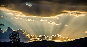 Sunrise over the Agua Tibia Wilderness | |
 Map of the United States | |
| Location | San Diego and Riverside counties, California, United States |
| Nearest city | Temecula, California |
| Coordinates | 33°25′15″N 116°59′09″W / 33.4208650°N 116.9858598°WCoordinates: 33°25′15″N 116°59′09″W / 33.4208650°N 116.9858598°W[1] |
| Area | 17,961 acres (72.69 km2) [2] |
| Established | January 5, 1975 |
| Governing body | U.S. Forest Service, USDA Bureau of Land Management |


Agua Tibia Wilderness (ATW) is a 17,961-acre (72.69 km2) protected area in Riverside and San Diego counties, in the U.S. state of California. It is mostly within the Palomar Ranger District of the Cleveland National Forest.[3] The area was originally protected as the Agua Tibia Primitive Area until January 1975 when it was added to the National Wilderness Preservation System with the passage of Public Law 93-632 by the United States Congress.[2] Between its inception and 1984, the ATW was San Diego County's only officially designated wilderness area.[4] The Spanish name, Agua Tibia, translates as warm water.
Its approximate boundaries are:[5]
- North – SR 79
- East – Arroyo Seco River
- South – Fray Creek
- West – Pala Road
Environment[]
There are no permanent streams in the ATW. The highest landform is Agua Tibia Mountain with an elevation of 4,779 feet (1,457 m).[6]
Though the summer climate is hot, with limited shade and no water sources, there were no fires in the ATW for 110 years. In the last two decades, there have been four fires including the Palomar Mountain Fire (1987), the Vail Fire (1989), the Agua Tibia Fire (2000), and the Poomacha Fire (2007).[5] Its pollution exposure is monitored within the San Diego Air Basin.[7]
Flora[]
The Agua Tibia Wilderness is home to rare and endemic plants. These include:
- Nevin's barberry (Mahonia nevinii)
- Rainbow manzanita (Arctostaphylos rainbowensis)
- Round-leaved boykinia (Boykinia rotundifolia)
- Vail Lake ceanothus (Ceanothus ophiochilus)
Agua Tibia Research Natural Area[]
The Agua Tibia Research Natural Area (ATRNA), located within the wilderness, comprises 480 acres (190 ha) of bigcone Douglas-fir—canyon live oak forest. The area was set aside for the study of this forest type in the Peninsular Range province and with emphasis on forest succession, long-range ecological changes and the effects of resource management practices. Bigcone Douglas-fir (Pseudotsuga macrocarpa) is a relict species and is endemic to Southern California. This population on the ATRNA is unique for its relatively great age, size, genetic purity, placement near the southern extent of the species' range, and for its remoteness and lack of disturbance by man. Other notable plants in the research area are Laguna linanthus (Linanthus orcuttii ssp. pacificus) and Hall's monardella (Monardella macrantha ssp. hallii). Both are listed as 1B by the California Native Plant Society's Rare Plant Program.[8][9]
References[]
- ^ "Agua Tibia Wilderness". Geographic Names Information System. United States Geological Survey.
- ^ Jump up to: a b "Agua Tibia wilderness". Wilderness.net. Retrieved 2008-12-14.
- ^ "Dripping Springs Campground, Cleveland National Forest". asmwest.com. Archived from the original on 2007-09-21. Retrieved 2007-11-02.
- ^ Jerry Schad (September 1998). Afoot & Afield in San Diego County (3rd ed.). Wilderness Press. ISBN 978-0-89997-229-9.
- ^ Jump up to: a b "Agua Tibia Mountain – General Information". Tom Chester. Archived from the original on 24 October 2007. Retrieved 2007-11-02.
- ^ "Agua Tibia Mountain". Peakbagger.com. Retrieved 2010-08-14.
- ^ Bruce D. Ryan (May 1990). "Lichens and air quality in the Agua Tibia Wilderness, California: a baseline study" (PDF). Retrieved 2007-11-02. Cite journal requires
|journal=(help) - ^ "The CNPS Ranking System". Rare Plant Program. California Native Plant Society. Archived from the original on 19 September 2010. Retrieved 2010-08-14.
- ^ "Establishment Record of the AguaTibia Natural Research Area" (PDF). US Forest Service. pp. 1–2. Retrieved 2010-08-14.
External links[]
| Authority control: National libraries |
|---|
- IUCN Category Ib
- Wilderness Areas of California
- Cleveland National Forest
- Protected areas of Riverside County, California
- Protected areas of San Diego County, California
- Natural history of the Peninsular Ranges
- Protected areas established in 1975
- 1975 establishments in California