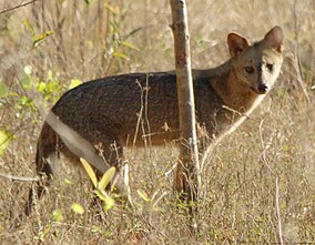
Aguaragüe National Park and Integrated Management Natural Area
| Aguaragüe National Park and Integrated Management Natural Area | |
|---|---|
 | |
| Location | Tarija Department |
| Coordinates | 21°30′0″S 63°36′0″W / 21.50000°S 63.60000°WCoordinates: 21°30′0″S 63°36′0″W / 21.50000°S 63.60000°W |
| Area | 108,307 ha (45,822 ha: National park, 62,485 ha: IMNA) |
| Established | April 20, 2000 |
| Governing body | Servicio Nacional de Áreas Protegidas (SERNAP) |
Aguaragüe National Park and Integrated Management Natural Area (Parque Nacional y Área Natural de Manejo Integrado Serranía del Aguaragüe) is a protected area in Bolivia situated in the Tarija Department, Gran Chaco Province. The national park covers the whole of Serranía del Aguaragüe, the easternmost mayor Sub-Andean range.
External links[]
- www.fundesnap.org / Aguaragüe National Park and Integrated Management Natural Area Archived 2011-07-26 at the Wayback Machine (Spanish)
Categories:
- National parks of Bolivia
- Geography of Tarija Department
- Gran Chaco
- Protected areas established in 2000
- 2000 establishments in Bolivia
- South American protected area stubs
