Ainring
Ainring | |
|---|---|
 Ainring | |
 Coat of arms | |
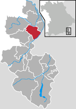
show Location of Ainring within Berchtesgadener Land district | |
 Ainring | |
| Coordinates: 47°48′49″N 12°56′34″E / 47.81361°N 12.94278°ECoordinates: 47°48′49″N 12°56′34″E / 47.81361°N 12.94278°E | |
| Country | Germany |
| State | Bavaria |
| Admin. region | Oberbayern |
| District | Berchtesgadener Land |
| Government | |
| • Mayor (2020–26) | Martin Öttl[1] |
| Area | |
| • Total | 32.97 km2 (12.73 sq mi) |
| Elevation | 459 m (1,506 ft) |
| Population (2020-12-31)[2] | |
| • Total | 9,847 |
| • Density | 300/km2 (770/sq mi) |
| Time zone | UTC+01:00 (CET) |
| • Summer (DST) | UTC+02:00 (CEST) |
| Postal codes | 83404 |
| Dialling codes | 08654 & 08656 |
| Vehicle registration | BGL |
| Website | www.ainring.de |


Ainring is a municipality in the district of Berchtesgadener Land, Upper Bavaria, Germany, near the border to Austria.
After World War II it was the site of a displaced persons camp.[3]

Personalities[]
Sons and daughters Ainrings[]
- Manuela Kraller (born 1981), singer
Connected to Ainring[]
- Eugen Sänger (1905-1964), engineer and pioneer in the field of aerospace;
- Hans Söllner (born 1955), Bavarian singer-songwriter; lives in Ainring
References[]
- ^ Liste der ersten Bürgermeister/Oberbürgermeister in kreisangehörigen Gemeinden, Bayerisches Landesamt für Statistik, accessed 19 July 2021.
- ^ "Tabellenblatt "Daten 2", Statistischer Bericht A1200C 202041 Einwohnerzahlen der Gemeinden, Kreise und Regierungsbezirke". Bayerisches Landesamt für Statistik (in German). June 2021.
- ^ Wyman, Mark (1998). Dps: Europe's Displaced Persons, 1945-1951. Cornell paperbacks. p. 116. ISBN 9780801485428. Retrieved December 27, 2012.
| show Towns and municipalities in Berchtesgadener Land |
|---|
| Wikimedia Commons has media related to Ainring. |
| show Authority control |
|---|
This Berchtesgadener Land location article is a stub. You can help Wikipedia by . |
Categories:
- Municipalities in Bavaria
- Berchtesgadener Land
- Displaced persons camps in the aftermath of World War II
- Upper Bavaria geography stubs