Aiyang Tlang
| Aiyang Tlang | |
|---|---|
 View of Aiyang Tlang from the nearest village, Dalian Headman Para. | |
| Highest point | |
| Elevation | 1,005 m (3,297 ft) |
| Coordinates | 21°40′23.78″N 92°36′16.01″E / 21.6732722°N 92.6044472°ECoordinates: 21°40′23.78″N 92°36′16.01″E / 21.6732722°N 92.6044472°E |
| Geography | |
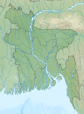 Aiyang Tlang Location in Bangladesh (on the border with Burma) | |
| Location | Bangladesh–Myanmar border |
| Parent range | Mowdok range |


Aiyang Tlang is a mountain on the Bangladesh–Myanmar border.[1] In 2020, Aiyang Tlang was confirmed to be the highest point in Bangladesh. The hill was discovered in the 1980s by Van Rausang Bawm of the local Bawm ethnic community.[2] On 13 November 2019, Engineer Jyotirmoy Dhar became the first Bangladeshi to climb the mountain.[3][4]
In November 2019, the height of Aiyang Tlang was measured by GPS (Global positioning system) and it was 3298 feet high above sea level.[5]
See also[]
References[]
- ^ "থানচিতে মিলল ৩২৯৮ ফুটের নতুন পর্বতশৃঙ্গের খোঁজ".
- ^ "৩২৯৮ ফুটের নতুন পর্বতশৃঙ্গের খোঁজ মিলল থানচিতে".
- ^ Nation, The New. "3300 feet highest hill discovered in Bandarban". The New Nation.
- ^ "New highest hill spotted in Bandarban | The Asian Age Online, Bangladesh". The Asian Age.
- ^ "New highest hill spotted in Bandarban | The Asian Age Online, Bangladesh". The Asian Age. Retrieved 5 May 2020.
This Chittagong Division location article is a stub. You can help Wikipedia by . |
This Myanmar location article is a stub. You can help Wikipedia by . |
Categories:
- Mountains of Myanmar
- Bangladesh–Myanmar border
- Mountains of Bangladesh
- International mountains of Asia
- Chittagong Division geography stubs
- Myanmar geography stubs