Akoko South-East
This article needs additional citations for verification. (May 2021) |
Akoko South-East
Uhami Isua | |
|---|---|
LGA | |
| Coordinates: 7°25′N 5°55′E / 7.42°N 5.91°E. | |
| Country | |
| State | Ondo State |
| Area | |
| • Land | 200 sq mi (530 km2) |
| Elevation | 1,142 ft (348 m) |
| Time zone | UTC+1 (WAT) |
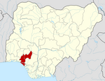
Akoko South-East[1] is a Local Government Area in Ondo State, Nigeria. Its headquarters are in (Akoko).[2] Akoko South-East is one of six Local Government Areas in the Northern Senatorial District of Ondo State.
Geography[]
The landscape is a mix of savannah and lowland forest. Annual rainfall ranges between 8cm-150cm (3.14in - 59.05in) per year with an average temperature of 28-35 °C (82-95 °F).[3] The territory is divided into Isua Oke and Isua Ile.
History[]
The origins of Isua can be traced back to the ancient Benin Empire.
Demographics[]
The population was 82,426 according to the 2006 census.
Governance[]
In Isua, only those who come from the royal Odovia family can be crowned as king.
The king resides in Isua Oke.
| Location | Area/district |
|---|---|
| Abulenla | Supare-Akoko |
| Ago Ajayi | Oba-Akoko |
| Ago Flower | Supare-Akoko |
| Ago Ojo | Oba-Akoko |
| Ago Oka | Oba-Akoko |
| Ago-Orikuta | Supare-Akoko |
| Akunagba -Akoko | Akungba-Akoko |
| Akunnu | Akunnu/Isowopo |
| Alegunle | Oka-Akoko |
| Auga | Akunnu/Isowopo |
| Ayegunle | Ifira-Akoko |
| Epinmi-Akoko | Epinmi-Akoko |
| Etioro | Akungba-Akoko |
| Iboropa | Akunnu/Isowopo |
| Igboegun | Supare-Akoko |
| Igbonla | Supare-Akoko |
| Ikakumo | Akunnu/Isowopo |
| Ikun-Akoko | Ifira-Akoko |
| Ipe-Akoko | Ipe Akoko |
| Ise | Akunnu/Isowopo |
| Isua-Akoko | Isua-Akoko |
| Iwaro | Oka-Akoko |
| Oka-Akoko | Oka-Akoko |
| Ose-Oba | Oba-Akoko |
| Sosan-Akoko | Sosan -Akoko |
Ipe Akoko is a town in Akoko South East in Ondo State.
Economy[]
It is an agricultural community. The town is situated on rocky terrain. It comprises ten quarters: Iba, Okun, Isinodo, Ilegbe, Igbede, Ugbe, Itoto, Ipaso, Uwi and Uthakpe quarters. The current king is His Royal Majesty, Oba Evangelist Francis Omokanjuola Apata, The Arogunbola II.
References[]
- ^ "Akoko South East (Local Government Area, Nigeria) - Population Statistics, Charts, Map and Location". www.citypopulation.de. Retrieved 2021-07-24.
- ^ "Figure 1: Map of Akoko South East Local Government Area, Ondo State..." ResearchGate. Retrieved 2021-06-02.
- ^ "Ekpemi Weather Forecast for today and this week - My Weather Watcher - Akoko South East - Ondo - Nigeria 2021". justweather.org. Retrieved 2021-07-20.
Chinwe I. Sanni1, Joshua Kayode2*, and Benson O. Ademiluyi (2019). Ethnobotany and Conservation of Indigenous Fruit Tree Species in Akoko Division of Ondo State, Nigeria.
- Local Government Areas in Ondo State
- Nigeria geography stubs

