Alenquer, Portugal
Alenquer | |
|---|---|
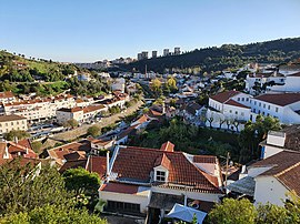 View of Alenquer from Praça Luís de Camões | |
 Flag  Coat of arms | |
 | |
| Coordinates: 39°03′N 9°01′W / 39.050°N 9.017°WCoordinates: 39°03′N 9°01′W / 39.050°N 9.017°W | |
| Country | |
| Region | Centro |
| Intermunic. comm. | Oeste |
| District | Lisbon |
| Parishes | 11 |
| Government | |
| • President | Paulo Sequeira Santos |
| Area | |
| • Total | 304.22 km2 (117.46 sq mi) |
| Population (2011) | |
| • Total | 43,267 |
| • Density | 140/km2 (370/sq mi) |
| Time zone | UTC±00:00 (WET) |
| • Summer (DST) | UTC+01:00 (WEST) |
| Local holiday | Ascension Day (date varies) |
| Website | http://www.cm-alenquer.pt |

Alenquer (Portuguese pronunciation: [ɐlẽˈkɛɾ] (![]() listen)) is a municipality in the Lisbon District, Portugal. The population in 2011 was 43,267,[1] in an area of 304.22 square kilometres (117.46 sq mi).[2] The present Mayor is Paulo Sequeira Santos.
listen)) is a municipality in the Lisbon District, Portugal. The population in 2011 was 43,267,[1] in an area of 304.22 square kilometres (117.46 sq mi).[2] The present Mayor is Paulo Sequeira Santos.
History[]
Alenquer received its Foral in 1212 by the hand of Infanta (Princess) Sancha, Lady of Alenquer, daughter of King Sancho I of Portugal.
Climate[]
Alenquer has a mediterranean climate with hot, dry summers and mild, wet winters. It has a total of 2763.9 annual hours of sunshine.[3]
| hideClimate data for Ota Airport, Alenquer, 1961-1990, altitude: 40 m (130 ft) | |||||||||||||
|---|---|---|---|---|---|---|---|---|---|---|---|---|---|
| Month | Jan | Feb | Mar | Apr | May | Jun | Jul | Aug | Sep | Oct | Nov | Dec | Year |
| Record high °C (°F) | 21.6 (70.9) |
24.5 (76.1) |
27.3 (81.1) |
29.4 (84.9) |
36.5 (97.7) |
43.5 (110.3) |
40.5 (104.9) |
40.9 (105.6) |
39.8 (103.6) |
33.6 (92.5) |
29.4 (84.9) |
22.8 (73.0) |
43.5 (110.3) |
| Average high °C (°F) | 14.7 (58.5) |
15.7 (60.3) |
17.7 (63.9) |
19.2 (66.6) |
22.0 (71.6) |
25.6 (78.1) |
28.4 (83.1) |
28.7 (83.7) |
27.4 (81.3) |
23.1 (73.6) |
18.0 (64.4) |
15.1 (59.2) |
21.3 (70.4) |
| Daily mean °C (°F) | 10.1 (50.2) |
11.0 (51.8) |
12.8 (55.0) |
14.4 (57.9) |
16.9 (62.4) |
20.0 (68.0) |
22.4 (72.3) |
22.5 (72.5) |
21.4 (70.5) |
17.8 (64.0) |
13.4 (56.1) |
10.7 (51.3) |
16.1 (61.0) |
| Average low °C (°F) | 5.5 (41.9) |
6.3 (43.3) |
7.9 (46.2) |
9.6 (49.3) |
11.8 (53.2) |
14.4 (57.9) |
16.4 (61.5) |
16.3 (61.3) |
15.4 (59.7) |
12.5 (54.5) |
8.8 (47.8) |
6.3 (43.3) |
10.9 (51.7) |
| Average rainfall mm (inches) | 84.6 (3.33) |
88.7 (3.49) |
61.8 (2.43) |
56.7 (2.23) |
44.1 (1.74) |
20.9 (0.82) |
4.5 (0.18) |
5.7 (0.22) |
23.2 (0.91) |
74.1 (2.92) |
103.6 (4.08) |
89.2 (3.51) |
657.1 (25.86) |
| Source: Instituto de Meteorologia[4] | |||||||||||||
Notable residents[]
- Pêro de Alenquer a 15th-century Portuguese explorer of the African coast
- Damião de Góis (1502 in Alenquer – 1574) an important Portuguese humanist philosopher.[5]
- John Smith Athelstane, 1st Count of Carnota (1813-1886 in Alenquer) a British diplomat, author, biographer and painter.
Parishes[]
Administratively, the municipality is divided into 11 civil parishes (freguesias):[6]
- Abrigada e Cabanas de Torres
- Aldeia Galega da Merceana e Aldeia Gavinha
- Alenquer (Santo Estêvão e Triana)
- Carnota
- Carregado e Cadafais
- Meca
- Olhalvo
- Ota
- Ribafria e Pereiro de Palhacana
- Ventosa
- Vila Verde dos Francos
See also[]
- Alenquer DOC, a wine designation.
References[]
- ^ Instituto Nacional de Estatística Archived November 15, 2016, at the Wayback Machine
- ^ "Áreas das freguesias, concelhos, distritos e país". Archived from the original on 2018-11-05. Retrieved 2018-11-05.
- ^ "Linha aérea dupla Carregado-Rio Maior" (PDF). REN. Retrieved 7 July 2021.
- ^ "Plano Municipal de Defesa da Floresta Contra Incêndios" (PDF). Alenquer Municipality. Retrieved 7 July 2021.
- ^ . Encyclopædia Britannica. 12 (11th ed.). 1911. p. 180–181.
- ^ Diário da República. "Law nr. 11-A/2013, page 552 8" (pdf) (in Portuguese). Retrieved 16 July 2014.
External links[]
| Wikivoyage has a travel guide for Alenquer. |
| Authority control |
|---|
This Lisbon location article is a stub. You can help Wikipedia by . |
Categories:
- Alenquer, Portugal
- Towns in Portugal
- Populated places in Lisbon District
- Municipalities of Lisbon District
- Municipalities of Portugal
- Lisbon geography stubs