Aleutian Range
| Aleutian Range | |
|---|---|
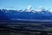
 Alaska Peninsula, Peulik Volcano and Ukinrek Maars | |
| Highest point | |
| Peak | Mount Redoubt |
| Elevation | 10,197 ft (3,108 m) |
| Coordinates | 60°29′07″N 152°44′35″W / 60.48528°N 152.74306°W |
| Dimensions | |
| Length | 600 mi (970 km) |
| Geography | |
 Map showing volcanoes on the Alaska Peninsula
| |
| Country | United States |
| State | Alaska |
| Range coordinates | 57°4′N 156°59.3′W / 57.067°N 156.9883°WCoordinates: 57°4′N 156°59.3′W / 57.067°N 156.9883°W |
| Borders on | Tordrillo Mountains |

The Aleutian Range is a major mountain range located in southwest Alaska. It extends from (80 miles/130 km southwest of Anchorage) to Unimak Island, which is at the tip of the Alaska Peninsula. It includes all of the mountains of the Peninsula. The Aleutian Range is special because of its large number of active volcanoes, which are also part of the larger Aleutian Arc. The mainland part of the range is about 600 miles (1000 km) long. The Aleutian Islands are (geologically) a partially submerged western extension of the range that stretches for another 1,600 km (1000 mi). However the official designation "Aleutian Range" includes only the mainland peaks and the peaks on Unimak Island. The range is almost entirely roadless wilderness. Katmai National Park and Preserve, a large national park within the range, must be reached by boat or plane.
The core Aleutian Range can be divided into three mountain groups. Listed from southwest to northeast, they are:
- Mountains of the Alaska Peninsula and Unimak Island
- Chigmit Mountains
- Neacola Mountains
See Aleutian Islands for the continuation of the range to the west of Unimak Island. Just to the north of the Aleutian Range are the Tordrillo Mountains, the southeasternmost extent of the Alaska Range.[1]
Selected mountains:
- Mount Redoubt (3,108 m), Chigmit Mountains
- Iliamna Volcano (3,054 m), Chigmit Mountains
- Mount Neacola, (2,873 m), Neacola Mountains
- Mount Shishaldin (2,857 m), Unimak Island
- Mount Pavlof (2,715 m), Alaska Peninsula
- Mount Veniaminof (2,508 m), Alaska Peninsula
- Isanotski Peaks (2,446 m), Unimak Island
- Mount Denison (2,318 m), Alaska Peninsula
- Mount Griggs, (2,317+ m), Alaska Peninsula
- Mount Douglas (2,153 m), Alaska Peninsula
- Mount Chiginagak (2,134 m), Alaska Peninsula
- Double Peak (2,078 m), Chigmit Mountains
- Mount Katmai (2,047 m), Alaska Peninsula
- Pogromni Volcano (2,002 m), Unimak Island
- Mount Okmok (1,073 m), Fox Islands
Volcanic eruptions[]

Two volcanoes erupted during the summer of 2008 on the eastern Aleutian Islands. On July 12, 2008, Mount Okmok erupted, and it continued to erupt for a month. A giant, rapidly moving ash and gas cloud shot up to a height of 15,240 m as a result of this eruption.[2]
Mount Kasatochi was home to the other eruption, which occurred on August 7 and 8. This eruption also sent up a gas cloud about 15,000 high. Together, these two power volcanic eruptions deposited emissions of trace gases an aerosols into the atmosphere. These emissions formed a sulfate aerosol layer that totaled a transfer of 1.6 Tg of SO2 into the stratosphere and disturbed flights over this area for a short period following the eruptions.[3]
Earthquakes[]
The 7.9 Mw Aleutian Islands earthquake occurred in June 2014 at an intermediate depth of 107 km.[4] The quake was caused by oblique normal faulting along the Aleutian Trench, a convergent boundary where the Pacific plate is subducting underneath the North American plate at around 59 mm/year.[5]
See also[]
References[]
- ^ "GNIS Detail – Tordrillo Mountains". Retrieved 21 November 2012.
- ^ "Explosive Eruption Of Okmok Volcano In Alaska". Science Daily. 21 July 2008. Retrieved 14 September 2016.
- ^ Schmale; Schneider; Jurkat (January 27, 2010). "Aerosol layers from the 2008 eruptions of Mount Okmok and Mount Kasatochi; in situ upper troposphere and lower stratosphere measurements of sulfate and organics over Europe" (PDF). Journal of Geophysical Research: Atmospheres. 115 (D2): D00L07. Bibcode:2010JGRD..115.0L07S. doi:10.1029/2009jd013628.
- ^ University of Portland (June 23, 2014). "Magnitude 7.9 ALEUTIAN ISLANDS, ALASKA" (PDF). iris.edu. Retrieved October 22, 2016.
- ^ "Poster of the Aleutian Islands, Alaska Earthquake of 23 June 2014 – Magnitude 7.9". June 24, 2014. Retrieved October 22, 2016.
External links[]
- Aleutian Range
- Mountains of Aleutians East Borough, Alaska
- Mountains of Kenai Peninsula Borough, Alaska
- Mountains of Kodiak Island Borough, Alaska
- Mountains of Lake and Peninsula Borough, Alaska
- Volcanic arcs
- Mountains of Alaska
- Mountain ranges of Alaska