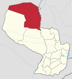
Alto Paraguay Department
Alto Paraguay | |
|---|---|
 Flag  Coat of arms | |
 | |
| Coordinates: 20°30′S 59°0′W / 20.500°S 59.000°WCoordinates: 20°30′S 59°0′W / 20.500°S 59.000°W | |
| Country | |
| Capital | Fuerte Olimpo |
| Government | |
| • Governor | (ANR) |
| Area | |
| • Total | 82,349 km2 (31,795 sq mi) |
| Population (2002)[citation needed] | |
| • Total | 15,008 |
| • Density | 0.18/km2 (0.47/sq mi) |
| Time zone | UTC-04 (AST) |
| • Summer (DST) | UTC-03 (ADT) |
| ISO 3166 code | PY-16 |
| Number of Districts | 2 |

Alto Paraguay (Spanish pronunciation: [ˈalto paɾaˈɣwaj]; Upper Paraguay) is a sparsely populated department of Paraguay. The capital is the town of Fuerte Olimpo.
In 1992, the Chaco Department was merged with Alto Paraguay.
Nature and national parks[]

Alto Paraguay contains a varied and large amount of natural resources, which is why this department is home to several national parks, each with different characteristics. The is the largest in the Paraguayan territory. The mentioned park is home to the hill , which is the highest point in the northern region of Paraguay. The dry surface is optimal for the growth of different kinds of cactus. Another park in this department, , is located in an area with several small lakes and is home to most of the fauna in the department. Other national parks in Alto Paraguay are and , which reside in dry regions.
Agriculture, livestock and deforestation[]


Paraguay's largest reserves of undeveloped fertile virgin forest covered land and lowest land prices are found in Alto Paraguay; thus, agriculture and cattle farming are starting to make inroads. The fertility of the Chaco's deep sedimentary soils is generally high, except in the westernmost parts, where there are very sandy soils, and some seasonal wetlands in the eastern plain. Annual rainfall is sufficient in the east (around 1200mm), fair in the center (around 900mm) and scarce in the west (around 700mm). The most challenging aspect for farmers is the lack of decent roads and infrastructure.
The advance of agriculture is inevitably at the expense of the area's native forest. During the two decades 1990 to 2010 Paraguay had one of the highest deforestation rates worldwide. The World Land Trust estimates deforestation in the Paraguay Chaco at over 200.000 hectare for 2008 alone [1]
The department's most important activity by far is cattle ranching, both extensive in the savannas of the east and intensive on the planted pastures of cleared land. Cultivation of sorghum, sugar cane and (in planning stage as of January 2009, for the arid west) jatropha are very recent developments.
Districts[]
The department is divided into five districts:[2]
See also[]
- List of high schools in Alto Paraguay
References[]
- ^ "Deforestation in Paraguay: Over 1500 football pitches lost a day in the Chaco". World Land Trust. 30 November 2009. Archived from the original on 2010-08-23. Retrieved 2010-01-14.
- ^ Dirección General de Estadística, Encuestas y Censos : Censo : Lista de Áreas de Variables de Personas Retrieved 5 March 2010
External links[]
| Wikimedia Commons has media related to Alto Paraguay Department. |
- Alto Paraguay Department
- States and territories established in 1992