Andanan River
| Andanan River | |
|---|---|
 Wawa River mouth | |
| Native name | Ilog Andanan (Tagalog) |
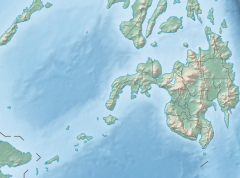
| Location | |
| Country | Philippines |
| Region | Caraga |
| Province | Agusan del Sur |
| Municipality | Sibagat, Bayugan |
| Physical characteristics | |
| Source | |
| • location | Sibagat, Agusan del Sur, Caraga Region |
| Mouth | Wawa River |
• location | Maygatasan, Bayugan City |
• coordinates | 8°51′3.2″N 125°48′50.4″E / 8.850889°N 125.814000°ECoordinates: 8°51′3.2″N 125°48′50.4″E / 8.850889°N 125.814000°E |
| Length | 38 km (24 mi) |
| Basin size | 12 km2 (4.6 sq mi) |
| Discharge | |
| • location | Wawa River |
| • average | 42 m3/s (1,500 cu ft/s) |
| Basin features | |
| Progression | Andanan–Wawa–Agusan |

Andanan River (Tagalog: Ilog Andanan; Cebuano: Suba sa Andanan) is a stream located in Sibagat, Agusan del Sur and Bayugan City, Caraga Region,[1] Philippines. It is a tributary of the larger Wawa River.
Geography[]
Andanan River is situated approximately 8.85089, 125.814 in the island of Mindanao.[2]
Andanan River headwaters from the of Sibagat, Agusan del Sur. It traverses along Barangay New Tubigon in Sibagat and the riverbank barangays of Bayugan City namely: San Juan, Berseba, Santo Niño, Calaitan, Santa Irene and Noli where its mouth located in Barangay Maygatasan joins with the larger Wawa River. Wawa River is one of the larger and longer rivers in the province of Agusan del Sur and a tributary river to the Agusan River.[3]
Crossings[]
There are two (2) permanent bridges cross the Andanan River
- Andanan Bridge (1) – Barangay Maygatasan, Bayugan City along the Pan-Philippine Highway Butuan-Davao Road
- Andanan Bridge (2) – Barangay New Tubigon, Sibagat, Agusan del Sur along the Butuan-Tandag Road that serves as road boundary connecting Barangay New Tubigon of Sibagat and Barangay San Juan of Bayugan City.
Watershed[]
Andanan River and its surrounding areas was declared as a nature reserve called the Andanan Watershed Forest Reserve (AWFR) proclaimed by virtue of Philippine Presidential Proclamation No. 734 dated May 29, 1991 with an area of 15,097 hectares comprises with eight (8) barangays namely; Sta. Irene, Calaitan, Berseba, Sto. Niño, Mt. Carmel, Mt. Ararat, San Juan all of Bayugan City and Barangay New Tubigon in Sibagat, Agusan del Sur.[4][5][6]
The areas of Andanan River is being proposed as Andanan Natural Park under the National Integrated Protected Areas System (NIPAS). This protected area has its own biological features of fauna and flora dipterocarp and premium species. Ecotourism sites like caves, waterfalls, lakes and unique rock formations are the mere features for tourist destination.[4]
The area covered by the proclamation is under the administrative jurisdiction, supervision and control of the Philippines Department of Environment and Natural Resources through its Forest management Bureau in coordination with other government agencies with objective of maintaining its usefulness as a source of water for domestic, agriculture, power generation and other forestry purposes.[6]
Andanan River Watershed supports potable drinking water and irrigation for Bayugan, Sibagat, and other areas of Agusan del Sur.[7]
See also[]
- Agusan River
- Wawa River (Agusan del Sur)
- Sibagat River
- Sibagat, Agusan del Sur
- Bayugan City
- Agusan del Sur Province
- List of rivers of the Philippines
References[]
- ^ "Region 13, List of Waterbodies | Water Quality Management Section". Retrieved 2021-04-17.
- ^ "GeoHack - Andanan River". geohack.toolforge.org. Retrieved 2021-04-17.
- ^ "The Mighty Rivers of Agusan | Len Joson". Retrieved 2021-04-17.
- ^ a b "Andanan Natural Park". mindanaopamb.buksu.edu.ph. Retrieved 2021-04-17.
- ^ "Andanan Watershed Forest Reserve - zxc.wiki". de.zxc.wiki. Retrieved 2021-04-17.
- ^ a b "Proclamation No. 734, s. 1991 | GOVPH". Official Gazette of the Republic of the Philippines. Retrieved 2021-04-17.
- ^ Fernandez - Gamalinda, Eve; Solania, Chennie (2018-09-20). "Species composition and habitat association of anurans within water systems of Andanan Watershed, Agusan del Sur, Caraga Region, Philippines". Environmental and Experimental Biology. 16: 159–168. doi:10.22364/eeb.16.15.
This article about a location in the Philippines is a stub. You can help Wikipedia by . |
- Rivers of the Philippines
- Landforms of Agusan del Sur
- Philippines geography stubs
- Asia river stubs