Andrelândia
This article may be expanded with text translated from the corresponding article in Portuguese. (March 2016) Click [show] for important translation instructions.
|


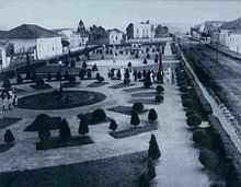
Andrelândia is a Brazilian municipality in the state of Minas Gerais. It is in the and includes the , located about 300 kilometres (190 mi) south of Belo Horizonte, the state capital.[1]
Andrelândia is 1,005 square kilometres (388 sq mi) in area and its population was 12,206 inhabitants in 2020, making it the 294th most populous city in Minas Gerais state and the second of the microregion.[2]
It was founded on July 20, 1868, with the name of Vila Bela do Turvo and consists of five districts: Turvo, Arantes, Bom Jardim, Madre de Deus do Rio Grande and San Vicente Ferrer. Over the years the districts turned into cities, leaving only Andrelândia in the seat, its single district.
The city has had several names throughout its history. It has had its current name since the state law 1160 of September 19, 1930.
See also[]
- List of municipalities in Minas Gerais
References[]
- ^ "Andrelândia - MG". Cidades.Net.
- ^ IBGE 2020
External links[]
- (in Portuguese) Website about the city
Coordinates: 21°44′S 44°18′W / 21.733°S 44.300°W

| Wikimedia Commons has media related to Andrelândia. |
This geographical article relating to Minas Gerais is a stub. You can help Wikipedia by . |
- Municipalities in Minas Gerais
- Minas Gerais geography stubs