Anetz
Anetz | |
|---|---|
Part of Vair-sur-Loire | |
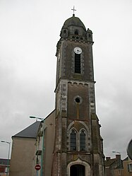 The church in Anetz | |
 Coat of arms | |
show Location of Anetz | |
 Anetz | |
| Coordinates: 47°22′59″N 1°06′06″W / 47.3831°N 1.1017°WCoordinates: 47°22′59″N 1°06′06″W / 47.3831°N 1.1017°W | |
| Country | France |
| Region | Pays de la Loire |
| Department | Loire-Atlantique |
| Arrondissement | Châteaubriant-Ancenis |
| Canton | Ancenis |
| Commune | Vair-sur-Loire |
| Area 1 | 14.83 km2 (5.73 sq mi) |
| Population (2017)[1] | 2,066 |
| • Density | 140/km2 (360/sq mi) |
| Demonym(s) | Anetziennes, Anetziens |
| Time zone | UTC+01:00 (CET) |
| • Summer (DST) | UTC+02:00 (CEST) |
| Postal code | 44150 |
| Elevation | 7–32 m (23–105 ft) |
| Website | http://www.pays-ancenis.com/ |
| 1 French Land Register data, which excludes lakes, ponds, glaciers > 1 km2 (0.386 sq mi or 247 acres) and river estuaries. | |


Anetz is a former commune in the Loire-Atlantique department in western France. On 1 January 2016, it was merged into the new commune of Vair-sur-Loire.[2]
Population[]
| Year | Pop. | ±% |
|---|---|---|
| 1793 | 908 | — |
| 1800 | 1,020 | +12.3% |
| 1806 | 1,232 | +20.8% |
| 1821 | 1,260 | +2.3% |
| 1831 | 1,244 | −1.3% |
| 1836 | 1,158 | −6.9% |
| 1841 | 1,108 | −4.3% |
| 1846 | 1,157 | +4.4% |
| 1851 | 1,030 | −11.0% |
| 1856 | 1,038 | +0.8% |
| 1861 | 1,030 | −0.8% |
| 1866 | 1,003 | −2.6% |
| 1872 | 890 | −11.3% |
| 1876 | 889 | −0.1% |
| 1881 | 879 | −1.1% |
| 1886 | 903 | +2.7% |
| 1891 | 846 | −6.3% |
| 1896 | 804 | −5.0% |
| 1901 | 786 | −2.2% |
| 1906 | 754 | −4.1% |
| 1911 | 727 | −3.6% |
| 1921 | 646 | −11.1% |
| 1926 | 630 | −2.5% |
| 1931 | 577 | −8.4% |
| 1936 | 561 | −2.8% |
| 1946 | 654 | +16.6% |
| 1954 | 532 | −18.7% |
| 1962 | 604 | +13.5% |
| 1968 | 687 | +13.7% |
| 1975 | 955 | +39.0% |
| 1982 | 1,211 | +26.8% |
| 1990 | 1,285 | +6.1% |
| 1999 | 1,368 | +6.5% |
| 2006 | 1,584 | +15.8% |
| 2009 | 1,872 | +18.2% |
Sights[]
- Le Château du Plessis de Vair


See also[]
- Communes of the Loire-Atlantique department
References[]
| Wikimedia Commons has media related to Anetz. |
This Loire-Atlantique geographical article is a stub. You can help Wikipedia by . |
Categories:
- Former communes of Loire-Atlantique
- Populated places disestablished in 2016
- Loire-Atlantique geography stubs