Angelniemi
Angelniemi | |
|---|---|
Former Municipality | |
| Angelniemen kunta Angelniemi kommun | |
 Coat of arms | |
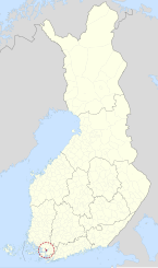 | |
| Country | |
| Region | Southwest Finland |
| Sub-region | Salo |
| Established | 1916 |
| Merged | 1967 |
| Area | |
| • Urban | 63.7 km2 (24.6 sq mi) |
| Population | |
| • Density | 0/km2 (0/sq mi) |
| • Urban density | 16.5/km2 (43/sq mi) |
| • Metro | 1,051 |
| statistics from 1961[3] | |
| Time zone | UTC+02:00 (EET) |
| • Summer (DST) | UTC+03:00 (EEST) |
| Climate | Dfb |
Angelniemi is a former municipality of Finland. It became part of Halikko in 1967. It was located on partly on the continent by the Halikonlahti Bay and partly on Kimito Island and is still nowadays the only part of the island where Finnish is the primary language. Today the population of the area is 398, but it rises during the summer because of the summer cottages.[7]


The center of the municipality was Kokkila, which lies on the continent. There is a cable ferry which connects Kokkila to the Kimito Island. Other isles of Angelniemi are Angelansaari, Kokkilansaari, Pikkusaari and Karhusaari.
Angelniemi congregation was established 1657 as a chapel of Halikko. Angelniemi became independent 1916 and it reached its high in 1957 at 1,217 people.[3] In 1967 Angelniemi was merged back to Halikko.
Villages[]
Ahtmaa, Angela, Asila, Esselpää, Isokylä, Kanamäki, Karviainen, Kokkila, Myllyperä, Paatelmaa, Peksala, Päärnäspää, Pöylä, Sapalahti, Tammenpää, Toppjoki, Torkkila, Tuiskula, Valttila
References[]
- ^ a b c d "Area of Finnish Municipalities 1.1.2018" (PDF). National Land Survey of Finland. Retrieved 30 January 2018.
- ^ a b c d "Preliminary population structure by area, 2021M01*-2021M03*". StatFin (in Finnish). Statistics Finland. Retrieved 2 May 2021.
- ^ a b Statistics of Angelniemi (in Finnish)
- ^ a b c d e f g h i j k l m n "Population according to language and the number of foreigners and land area km2 by area as of 31 December 2008". Statistics Finland's PX-Web databases. Statistics Finland. Retrieved 29 March 2009.
- ^ a b "List of municipal and parish tax rates in 2021" (PDF). Tax Administration of Finland. 1 December 2020. Retrieved 10 April 2021.
- ^ a b c d e "Population according to age (1-year) and sex by area and the regional division of each statistical reference year, 2003-2020". StatFin. Statistics Finland. Retrieved 2 May 2021.
- ^ Angelniemen kyläyhdistys (in Finnish)]
| Municipalities |  | |
|---|---|---|
| Former municipalities |
| |
Coordinates: 60°18′N 22°54′E / 60.300°N 22.900°E

This Western Finland location article is a stub. You can help Wikipedia by . |
- Salo, Finland
- Former municipalities of Finland
- 1916 establishments in Finland
- Western Finland Province geography stubs