Ankeny Regional Airport
Ankeny Regional Airport | |||||||||||||||
|---|---|---|---|---|---|---|---|---|---|---|---|---|---|---|---|
 | |||||||||||||||
| Summary | |||||||||||||||
| Airport type | Public | ||||||||||||||
| Owner | Polk County Aviation Authority | ||||||||||||||
| Serves | Ankeny, Iowa | ||||||||||||||
| Elevation AMSL | 910 ft / 277 m | ||||||||||||||
| Coordinates | 41°41′28″N 093°33′59″W / 41.69111°N 93.56639°W | ||||||||||||||
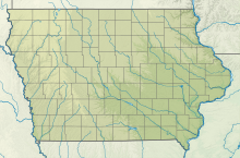
| Map | |||||||||||||||
 IKV | |||||||||||||||
| Runways | |||||||||||||||
| |||||||||||||||
| Statistics | |||||||||||||||
| |||||||||||||||
Ankeny Regional Airport (ICAO: KIKV, FAA LID: IKV) is a mile (2 km) southeast of Ankeny, in Polk County, Iowa. It is owned by the Polk County Aviation Authority.[1]
Facilities[]

The airport covers 442 acres (179 ha) at an elevation of 910 feet (277 m). It has two concrete runways: 18/36 is 5,500 by 100 ft (1,676 by 30 m) and 4/22 is 4,200 by 75 ft (1,280 by 23 m). The airport opened in February 1994.[2] In the year ending September 11, 2007 the airport had 48,600 general aviation aircraft operations, average 133 per day. In January 2017, 105 aircraft were based at this airport: 91 single-engine, 8 multi-engine, 5 jet and 1 military.[1]

Accidents and incidents[]
On February 5, 2008 a Swearingen SA-226AT Merlin IV operated by McNeely Charter Service was involved in an incident. A snowplow driver told the pilot he was clear to takeoff after he had plowed a part of the runway. As the plane began its takeoff roll, its left landing gear encountered deeper snow causing the plane to swerve to the left. The airplane was severely damaged when its nose landing gear hit a snowbank. The probable cause of the accident: the pilot failed to maintain directional control.
References[]
- ^ a b c FAA Airport Form 5010 for IKV PDF. Federal Aviation Administration. Effective Jan 5, 2017.
- ^ "Ankeny Regional Airport History".
External links[]
- Ankeny Regional (IKV) at Iowa DOT Office of Aviation
- Exec 1 Aviation, the fixed-base operator (FBO)
- Aerial photo as of 25 March 2000 from USGS The National Map
- FAA Terminal Procedures for IKV, effective February 24, 2022
- Resources for this airport:
- FAA airport information for IKV
- AirNav airport information for KIKV
- ASN accident history for IKV
- FlightAware airport information and live flight tracker
- NOAA/NWS weather observations: current, past three days
- SkyVector aeronautical chart, Terminal Procedures
- Airports in Iowa
- Transportation buildings and structures in Polk County, Iowa
- Ankeny, Iowa

