Anna Paulowna
This article includes a list of references, related reading or external links, but its sources remain unclear because it lacks inline citations. (March 2013) |
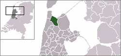
Anna Paulowna | |
|---|---|
Former municipality | |
 Church and the old center of the village Anna Paulowna. | |
 Flag  Coat of arms | |
 | |
| Coordinates: 52°52′N 4°52′E / 52.87°N 4.87°ECoordinates: 52°52′N 4°52′E / 52.87°N 4.87°E | |
| Country | Netherlands |
| Province | North Holland |
| Municipality | Hollands Kroon |
| Area (2006) | |
| • Total | 78.81 km2 (30.43 sq mi) |
| • Land | 74.43 km2 (28.74 sq mi) |
| • Water | 4.38 km2 (1.69 sq mi) |
| Population (1 January 2007) | |
| • Total | 13,999 |
| • Density | 188/km2 (490/sq mi) |
| Source: CBS, Statline. | |
| Time zone | UTC+1 (CET) |
| • Summer (DST) | UTC+2 (CEST) |
| Postcode | 1760-1766 |
| Area codes | 0223, 0224 |
| Website | www.annapaulowna.nl |

Anna Paulowna (Dutch pronunciation: [ˈɑnaː pəˈloːnaː] (![]() listen)) is a former municipality and a town in the Netherlands, in the province of North Holland. The former municipality derives its name from the Anna Paulownapolder, which was laid dry in 1846 during the reign of King William II of the Netherlands and in turn named after his wife, Queen Anna Paulowna of Russia. Since 2012, Anna Paulowna has been a part of the new municipality of Hollands Kroon.
listen)) is a former municipality and a town in the Netherlands, in the province of North Holland. The former municipality derives its name from the Anna Paulownapolder, which was laid dry in 1846 during the reign of King William II of the Netherlands and in turn named after his wife, Queen Anna Paulowna of Russia. Since 2012, Anna Paulowna has been a part of the new municipality of Hollands Kroon.
Population centres[]
The former municipality of Anna Paulowna consisted of the following cities, towns, villages and/or districts: Anna Paulowna, Breezand, Nieuwesluis, Van Ewijcksluis, and Wieringerwaard.
Transportation[]
The town is served by Anna Paulowna railway station.
Local government[]
The former municipal council of Anna Paulowna consisted of 15 seats. After the the seats were divided as follows:
See also[]
References[]
- Statistics are taken from the SDU Staatscourant
| Wikimedia Commons has media related to Anna Paulowna. |
| Authority control |
|---|
This North Holland location article is a stub. You can help Wikipedia by . |
- Former municipalities of North Holland
- Hollands Kroon
- Populated places in North Holland
- North Holland geography stubs