Apiacá, Espírito Santo
Apiacá
Município de Apiacá | |
|---|---|
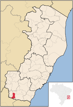 Location of Apiacá in Espírito Santo | |
 Apiacá Location of Apiacá in Brazil | |
| Coordinates: 21°09′14″S 41°34′04″W / 21.15389°S 41.56778°WCoordinates: 21°09′14″S 41°34′04″W / 21.15389°S 41.56778°W | |
| Country | Brazil |
| Region | Southeast |
| Founded | August 16, 1958 |
| Government | |
| • Mayor | Betinho (i.e., Humberto Alves de Souza; PRP, 2013–2016) |
| Area | |
| • Total | 194 km2 (75 sq mi) |
| Population (2020 [1]) | |
| • Total | 7,554 |
| • Density | 39/km2 (100/sq mi) |
| Demonym(s) | Apiacaense |
| Time zone | UTC−3 (BRT) |

Apiacá is a municipality located in the Brazilian state of Espírito Santo. It covers 194 km2 (75 sq mi), and has a population of 7,554 with a population density of 41 inhabitants per square kilometer.[2]
References[]
Capital: Vitória | ||||||||||
| Mesoregion Central |
|  | ||||||||
| Mesoregion Litoral Norte |
| |||||||||
| Mesoregion Noroeste |
| |||||||||
| Mesoregion Sul |
| |||||||||
This geographical article relating to Espírito Santo is a stub. You can help Wikipedia by . |
Categories:
- Municipalities in Espírito Santo
- Espírito Santo geography stubs