Apihimal Rural Municipality
Apihimal Rural Municipality
अपि हिमाल गाउँपालिका | |
|---|---|
 Apihimal Rural Municipality
| |
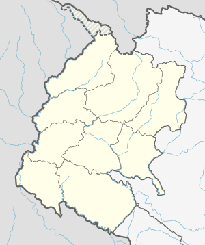
 Apihimal Rural Municipality Location of Apihimal in province | |
| Coordinates: 29°51′37″N 80°54′24″E / 29.86022°N 80.9067°ECoordinates: 29°51′37″N 80°54′24″E / 29.86022°N 80.9067°E | |
| Country | |
| Province | Sudurpashchim Province |
| District | Darchula District |
| Government | |
| • Type | Local government |
| • Chairperson | Dharmananda Singh Manyal |
| • Administrative Head | Promod Singh Manyal |
| Area | |
| • Total | 613.95 km2 (237.05 sq mi) |
| Population | |
| • Total | 6,779 |
| • Density | 11/km2 (29/sq mi) |
| Time zone | UTC+05:45 (Nepal Standard Time) |
| Website | http://apihimalmun.gov.np |
Apihimal (Nepali: अपि हिमाल) is a Rural council (Gaupalika) in Darchula District in the Sudurpashchim Province of far-western Nepal.[1]
Apihimal has a population of 6779.The land area is 613.95 km2.[2]
Etymology[]
The rural council has named after the Api (mountain), here the word Himal stands for the Nepali translation of Mountain.
Geography[]
There are mountains such as Api, Nampa, Kapchuli and Jethi in this rural municipality.[3]
References[]
- ^ "Ministry of Federal Affairs". Retrieved 6 July 2020.
- ^ "National Population and Housing Census 2011(National Report)" (PDF). Central Bureau of Statistics. Government of Nepal. 2012. Archived from the original (PDF) on 2013-04-18. Retrieved 2012-01-01.
- ^ http://apihimalmun.gov.np/
Categories:
- Rural municipalities in Darchula District
- Rural municipalities of Nepal established in 2017
- Sudurpashchim Province geography stubs


