Aquarius Plateau
This article needs additional citations for verification. (June 2021) |
Coordinates: 38°05′N 111°30′W / 38.083°N 111.500°W The Aquarius Plateau is a physiographic region in the High Plateaus Section of the Colorado Plateau Province. It is located within Garfield and Wayne counties in south-central Utah.

Geography[]
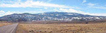
The plateau, a tectonic uplift on the much larger Colorado Plateau landform, is the highest in Utah.[1][2] It is over 900 square miles (2330 km²) of mostly forested highland, much of which is part of Dixie National Forest.
It has over 50,000 acres (200 km²) of rolling hilly terrain above 11,000 feet (3350 m). The plateau includes Boulder Mountain which peaks at 11,328 feet (3,452.8 m) at Bluebell Knoll.
Parks[]
Parks and protected areas on the Aquarius Plateau or its perimeter include Bryce Canyon National Park, Capitol Reef National Park, and the Dixie National Forest.
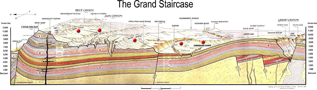
Section diagram[]
See also[]
- Markagunt Plateau
- Cedar Breaks National Monument
- United States physiographic region
| Wikimedia Commons has media related to Aquarius Plateau. |
References[]
- ^ Flint, Richard Foster; Denny, Charles Storrow (1958). "Quaternary geology of Boulder Mountain, Aquarius Plateau, Utah". U.S. Geological Survey Bulletin. 1061-d: 104. doi:10.3133/b1061D.
- ^ Morris, Jesse L.; Brunelle, Andrea; Munson, A. Steven; Spencer, Jessica; Power, Mitchell J. (October 2013). "Holocene vegetation and fire reconstructions from the Aquarius Plateau, Utah, USA". Quaternary International. 310: 111–123. doi:10.1016/j.quaint.2012.10.055.
External links[]
This article about a location in Utah is a stub. You can help Wikipedia by . |
- Plateaus of Utah
- Colorado Plateau
- Grand Staircase–Escalante National Monument
- Landforms of Garfield County, Utah
- Landforms of Wayne County, Utah
- Utah geography stubs