Araguaína
Araguaína | |
|---|---|
 Flag  Seal | |
 Location of Araguaína in the state of Tocantins | |
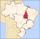
 Araguaína Location of Araguaína in Brazil | |
| Coordinates: 07°11′27″S 48°12′25″W / 7.19083°S 48.20694°W | |
| Country | Brazil |
| Region | Norte |
| State | Tocantins |
| Founded | 14 November 1958 |
| Government | |
| • Mayor | Ronaldo Dimas (PSDB) (2013 - 2016) |
| Area | |
| • Total | 3,920.1 km2 (1,513.6 sq mi) |
| Elevation | 227 m (745 ft) |
| Population (2020 [1]) | |
| • Total | 183,381 |
| • Density | 38.33/km2 (99.3/sq mi) |
| Demonym(s) | Araguainese |
| Time zone | GMT-3 |
| Postal code | 77801 to 77901 |
| Area code(s) | (+55) 63 |
| Website | http://www.araguaina.to.gov.br/ |

Coordinates: 07°11′27″S 48°12′25″W / 7.19083°S 48.20694°W Araguaína (Brazilian Portuguese: [aɾagwaˈinɐ]) is a municipality located in the Brazilian state of Tocantins. Its population was 183,381 (2020), and its area is 4,000.40 square kilometres (1,544.56 sq mi).
Higher education[]
The city has campuses from several higher education institutions.
There are two campuses of the public Federal University of Tocantins State (UFT). One campus is in the neighborhood Cimba, which has courses in Portuguese, English, Mathematics, physics, chemistry, geography, history, logistics, cooperativism, and tourism. The other campus is outside of the city, which has courses in veterinary sciences and zoology.
The city is home to the private university ITPAC, an educational institute offering medical, dentistry, and law classes.
Another private university is Santa Cruz, which has courses in law.
The private university Facit has courses in ortodontology, and software development.
Transport[]
Public transport in the city is done by the bus companies Cooperlota and Lontra.
The city is served by Araguaína Airport.
References[]
- ^ "IBGE 2020". Retrieved 26 January 2021.
| show |
|---|
| show Authority control |
|---|
This Tocantins, Brazil location article is a stub. You can help Wikipedia by . |
- Municipalities in Tocantins
- 1958 establishments in Brazil
- Tocantins geography stubs