Aravansay
| Aravansay | |
|---|---|
 | |
 | |
| Location | |
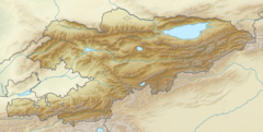
| Country | Kyrgyzstan, Uzbekistan |
| Physical characteristics | |
| Source | Kichi-Alay range |
| Mouth | |
• coordinates | 40°37′07″N 72°21′39″E / 40.6186°N 72.3609°ECoordinates: 40°37′07″N 72°21′39″E / 40.6186°N 72.3609°E |
| Length | 102 km (63 mi) |
| Basin size | 1,960 km2 (760 sq mi) |
| Basin features | |
| Progression | → Great Fergana Canal→ Syr Darya→ North Aral Sea |
The Aravansay (Kyrgyz: Аравансай, Uzbek: Aravonsoy) is a river in Kyrgyzstan and Uzbekistan. Its source is in the Kichi-Alay range, part of the Alay Range, and it discharges into the , one of the canals of the Fergana Valley. The river is 102 km (63 mi) long, and the watershed covers 1,960 km2 (760 sq mi).[1] In its upper course, it is called Gezart, in its middle course Chilisay. Its largest tributaries are the Kyrgyzata, Koschan, Agart and Akdöbö. The main settlements along the river Aravansay are the villages Jangy-Nookat and Aravan.[1] Near the village Kara-Koktu it passes through the Dangi Canyon.[2]
References[]
- ^ a b "Аравансай" [Aravansay] (PDF). Кыргызстандын Географиясы [Geography of Kyrgyzstan] (in Kyrgyz). Bishkek. 2004. p. 182.
- ^ "Сюрприз үңкүрү" [Suprise cave] (PDF). Кыргызстандын Географиясы [Geography of Kyrgyzstan] (in Kyrgyz). Bishkek. 2004. p. 318.
Categories:
- Tributaries of the Syr Darya
- Rivers of Kyrgyzstan
- Rivers of Uzbekistan
- Asia river stubs
- Kyrgyzstan geography stubs