Arga Makmur
Arga Makmur | |
|---|---|
| Coordinates: 3°26′16.3″S 103°11′43.06″E / 3.437861°S 103.1952944°ECoordinates: 3°26′16.3″S 103°11′43.06″E / 3.437861°S 103.1952944°E | |
| Country | |
| Province | Bengkulu |
| Regency | North Bengkulu Regency |
| District | Arga Makmur District |
| Elevation | 531 ft (162 m) |
| Population (2010) | |
| • Total | 47,457[1] |
| Time zone | UTC+7 (Indonesia Western Standard Time) |
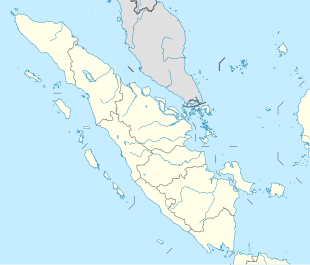
Arga Makmur is a town, district and the seat of North Bengkulu Regency in Bengkulu province, Indonesia. Its population is 47,457.[1]: 543–544
Climate[]
Arga Makmur has a tropical rainforest climate (Af) with heavy to very heavy rainfall year-round.
| Climate data for Arga Makmur | |||||||||||||
|---|---|---|---|---|---|---|---|---|---|---|---|---|---|
| Month | Jan | Feb | Mar | Apr | May | Jun | Jul | Aug | Sep | Oct | Nov | Dec | Year |
| Average high °C (°F) | 30.5 (86.9) |
31.0 (87.8) |
31.0 (87.8) |
31.2 (88.2) |
31.2 (88.2) |
31.1 (88.0) |
30.9 (87.6) |
30.9 (87.6) |
30.6 (87.1) |
30.4 (86.7) |
30.3 (86.5) |
30.2 (86.4) |
30.8 (87.4) |
| Daily mean °C (°F) | 25.9 (78.6) |
26.2 (79.2) |
26.2 (79.2) |
26.5 (79.7) |
26.4 (79.5) |
26.1 (79.0) |
25.8 (78.4) |
25.9 (78.6) |
25.8 (78.4) |
25.9 (78.6) |
25.8 (78.4) |
25.8 (78.4) |
26.0 (78.8) |
| Average low °C (°F) | 21.3 (70.3) |
21.4 (70.5) |
21.4 (70.5) |
21.8 (71.2) |
21.7 (71.1) |
21.1 (70.0) |
20.7 (69.3) |
20.9 (69.6) |
21.1 (70.0) |
21.4 (70.5) |
21.4 (70.5) |
21.4 (70.5) |
21.3 (70.3) |
| Average precipitation mm (inches) | 321 (12.6) |
274 (10.8) |
302 (11.9) |
294 (11.6) |
224 (8.8) |
164 (6.5) |
153 (6.0) |
191 (7.5) |
237 (9.3) |
337 (13.3) |
367 (14.4) |
352 (13.9) |
3,216 (126.6) |
| Source: Climate-Data.org[2] | |||||||||||||
References[]
- ^ a b "Population of Indonesia by Village: Result of 2010 Population Census" (PDF). Statistics Indonesia. Archived from the original (PDF) on 6 April 2013. Retrieved 2020-11-11.
- ^ "Climate: Arga Makmur". Climate-Data.org. Retrieved November 11, 2020.
 | This Bengkulu location article is a stub. You can help Wikipedia by . |
Categories:
- North Bengkulu Regency
- Regency seats of Bengkulu
- Sumatra geography stubs