Arrondissement of Roeselare
This article does not cite any sources. (March 2007) |
Arrondissement of Roeselare
Arrondissement Roeselare | |
|---|---|
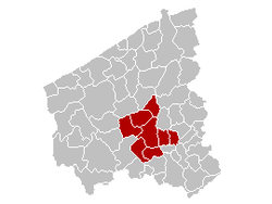 Location of the arrondissement in West Flanders | |
| Coordinates: 50°55′N 03°10′E / 50.917°N 3.167°ECoordinates: 50°55′N 03°10′E / 50.917°N 3.167°E | |
| Country | |
| Region | |
| Province | |
| Municipalities | 8 |
| Area | |
| • Total | 271.54 km2 (104.84 sq mi) |
| Population (1 January 2017) | |
| • Total | 150,742 |
| • Density | 560/km2 (1,400/sq mi) |
| Time zone | UTC+1 (CET) |
| • Summer (DST) | UTC+2 (CEST) |

The Arrondissement of Roeselare (Dutch: Arrondissement Roeselare; French: Arrondissement de Roulers) is one of the eight administrative arrondissements in the Province of West Flanders, Belgium.
The Administrative Arrondissement of Roeselare consists of the following municipalities:
This West Flanders location article is a stub. You can help Wikipedia by . |
Categories:
- Arrondissements of West Flanders
- West Flanders geography stubs