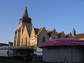
Arrou
Arrou | |
|---|---|
Part of Commune nouvelle d'Arrou | |
 | |
 Coat of arms | |
show Location of Arrou | |
 Arrou | |
| Coordinates: 48°06′05″N 1°07′26″E / 48.1014°N 1.1239°ECoordinates: 48°06′05″N 1°07′26″E / 48.1014°N 1.1239°E | |
| Country | France |
| Region | Centre-Val de Loire |
| Department | Eure-et-Loir |
| Arrondissement | Châteaudun |
| Canton | Brou |
| Commune | Commune nouvelle d'Arrou |
| Area 1 | 64.98 km2 (25.09 sq mi) |
| Population (2017)[1] | 1,540 |
| • Density | 24/km2 (61/sq mi) |
| Time zone | UTC+01:00 (CET) |
| • Summer (DST) | UTC+02:00 (CEST) |
| Postal code | 28290 |
| Elevation | 138–220 m (453–722 ft) (avg. 164 m or 538 ft) |
| 1 French Land Register data, which excludes lakes, ponds, glaciers > 1 km2 (0.386 sq mi or 247 acres) and river estuaries. | |


Arrou is a former commune in the Eure-et-Loir department in northern France. On 1 January 2017, it was merged into the new commune Commune nouvelle d'Arrou.[2]
Population[]
| Year | Pop. | ±% |
|---|---|---|
| 1962 | 1,836 | — |
| 1968 | 1,957 | +6.6% |
| 1975 | 1,841 | −5.9% |
| 1982 | 1,825 | −0.9% |
| 1990 | 1,777 | −2.6% |
| 1999 | 1,770 | −0.4% |
| 2008 | 1,683 | −4.9% |
| 2014 | 1,598 | −5.1% |
See also[]
- Communes of the Eure-et-Loir department
- Perche
References[]
- ^ Téléchargement du fichier d'ensemble des populations légales en 2017, INSEE
- ^ Arrêté préfectoral 25 May 2016 (in French)
| Wikimedia Commons has media related to Arrou. |
This Eure-et-Loir geographical article is a stub. You can help Wikipedia by . |
Categories:
- Former communes of Eure-et-Loir
- Perche
- Eure-et-Loir geography stubs