Arue, French Polynesia
Arue | |
|---|---|
 The coastline of Arue, with Papeete on the horizon | |
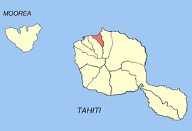 Location of the commune (in red) within the Windward Islands. The atoll of Tetiaroa lies outside of the map. | |
show Location of Arue | |
| Coordinates: 17°30′58″S 149°30′42″W / 17.5161°S 149.5117°WCoordinates: 17°30′58″S 149°30′42″W / 17.5161°S 149.5117°W | |
| Country | France |
| Overseas collectivity | French Polynesia |
| Subdivision | Windward Islands |
| Government | |
| • Mayor (2020–2026) | Teura Iriti |
| Area 1 | 20.5 km2 (7.9 sq mi) |
| Population (2017) | 10,243 |
| • Density | 500/km2 (1,300/sq mi) |
| Time zone | UTC−10:00 |
| INSEE/Postal code | 98712 /98701 |
| Elevation | 0–1,305 m (0–4,281 ft) |
| 1 French Land Register data, which excludes lakes, ponds, glaciers > 1 km2 (0.386 sq mi or 247 acres) and river estuaries. | |


Arue is a commune in the suburbs of Papeete in French Polynesia, an overseas territory of France in the Pacific Ocean. Arue is located on the island of Tahiti, in the administrative subdivision of the Windward Islands,[1] themselves part of the Society Islands. At the 2017 census it had a population of 10,243.[2]
The commune of Arue includes the atoll of Tetiaroa,[3] population 240,[2] (5.85 km2/2.26 sq. miles; property of Marlon Brando's family), located 58 km (36 mi) north of Tahiti.
History[]
The area of Arue was first settled by travelers from Asia during the year of 1000. They had built houses out of grass and mud. The Polynesians had hunted fish with spears. Captain James Cook had arrived at Tahiti to chart the coast.
Geography[]
The Papenoo River runs close to Arue in the east.
References[]
- ^ Décret n° 2005-1611 du 20 décembre 2005 pris pour l'application du statut d'autonomie de la Polynésie française, Légifrance
- ^ Jump up to: a b Répartition de la population en Polynésie française en 2017, Institut de la statistique de la Polynésie française
- ^ Décret n°72-407 du 17 mai 1972 portant création de communes dans le territoire de la Polynésie française, Légifrance
| Wikimedia Commons has media related to Arue (Tahiti). |
| show Authority control |
|---|
This French Polynesia-related geography article is a stub. You can help Wikipedia by . |
- Communes of French Polynesia
- French Polynesia geography stubs