Aruwimi River
| Aruwimi River Ituri River | |
|---|---|
 | |
 Location of mouth in the DR Congo | |
| Location | |
| Country | Democratic Republic of the Congo |
| Physical characteristics | |
| Source | Blue Mountains |
| • location | Lake Albert |
| Mouth | Congo River |
• location | Basoko |
• coordinates | 1°13′24″N 23°35′39″E / 1.223209°N 23.594298°ECoordinates: 1°13′24″N 23°35′39″E / 1.223209°N 23.594298°E |
| Length | 1,030 km (640 mi) |
| Basin size | 116,100 km2 (44,800 sq mi) |
| Discharge | |
| • average | 2,000 m3/s (71,000 cu ft/s) |
| Basin features | |
| River system | Congo River |
| Tributaries | |
| • left | Nepoko River |


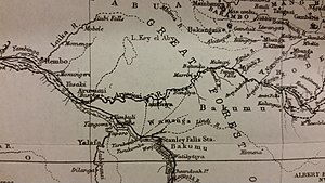
The Aruwimi River is a tributary of the Congo River, located to the north and east of the Congo.[1]:Vol.Two, 214
The Aruwimi begins as the Ituri River, which rises near Lake Albert,[2] in the savannas north of the Kibale River watershed. It then runs generally south southwest until it is joined by the Shari River which flows by Bunia. The Ituri then turns west, through the Ituri Forest, becoming the Aruwimi where the Nepoko (or Nepoki) River joins it, at the town of . The river continues westward, joining the Congo at Basoko. The length of the Aruwimi–Ituri is about 1,030 kilometres (640 mi), with the Ituri being about 650 kilometres (400 mi) and the Aruwimi about 380 kilometres (240 mi).[2] The Aruwimi is about 1.5 kilometres (0.93 mi) wide where it joins the Congo.
The watershed of the Ituri/Aruwimi is almost entirely dense forest, with just a handful of villages along its course, and crossed by roads in about four places. The Kango language (SIL code KZY) is spoken by several thousand villagers just south of Avakubi, and upper reaches of the Ituri are inhabited by the Mbuti (Pygmies).
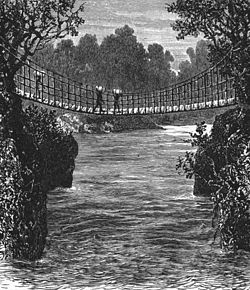
The Aruwimi was explored by Henry Morton Stanley during his 1887 expedition to "rescue" Emin Pasha. The cataracts above Yambuya made it impossible to use the river for navigation, and the expedition had to go by land, with tremendous difficulty.
Tributaries:
Settlements:
References[]
- ^ Stanley, H.M., 1899, Through the Dark Continent, London: G. Newnes, Vol. One ISBN 0486256677, Vol. Two ISBN 0486256685
- ^ Jump up to: a b Bossche, J.P. vanden; G. M. Bernacsek (1990). Source Book for the Inland Fishery Resources of Africa, Volume 1. Food and Agriculture Organization of the United Nations. p. 333. ISBN 978-92-5-102983-1.
External links[]
| hide | ||
|---|---|---|
| Congo left bank (south) |  | |
| Kasai basin | ||
| Congo right bank (north) | ||
| Lualaba and tributaries | ||
| Other | ||
| Authority control |
|
|---|
- Rivers of the Democratic Republic of the Congo
- Tributaries of the Congo River