Asago, Hyōgo
Asago
朝来市 | |
|---|---|
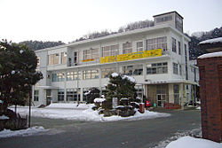 Asago City Hall | |
 Flag  Emblem | |
 Location of Asago in Hyōgo Prefecture | |
 Asago Location in Japan | |
| Coordinates: 35°20′N 134°51′E / 35.333°N 134.850°ECoordinates: 35°20′N 134°51′E / 35.333°N 134.850°E | |
| Country | Japan |
| Region | Kansai |
| Prefecture | Hyōgo Prefecture |
| Government | |
| • Mayor | Katsuaki Taji (since May 2009) |
| Area | |
| • Total | 402.98 km2 (155.59 sq mi) |
| Population (April 30, 2017) | |
| • Total | 31,248 |
| • Density | 78/km2 (200/sq mi) |
| Time zone | UTC+09:00 (JST) |
| City hall address | 213-1 Higashitani, Wadayama-cho, Asago-shi, Hyogo-ken 669-5292 |
| Website | www.city.asago.hyogo.jp |
| Symbols | |
| Flower | Cherry blossom |
| Tree | Zelkova serrata |

Asago (朝来市, Asago-shi) is a city located in northern Hyōgo Prefecture, Japan. The modern city of Asago was established on April 1, 2005, from the merger of the former town of Asago absorbing the towns of Ikuno, Santō and Wadayama (all from Asago District).
As of April 30, 2017, the city has an estimated population of 31,248, with 12,355 households,[1] and a population density of 82.52 persons per km². The total area is 402.98 km².
History[]
Asago was founded on March 31, 1954, from the merger of the former villages of Yamaguchi and Nakagawa.[2] By 2004, the town had an estimated population of 7,465 and a density of 57.33 persons per km². The total area was 130.20 km².[3] On April 1, 2005, Asago absorbed the towns of Ikuno, Santō and Wadayama (all from Asago District) to create the city of Asago.
Geography[]
This town is located in the north of Hyogo Prefecture. It is located in the east of Chūgoku Mountains, and the mountains and forests were occupy 93% of the town.[4] The Maruyama flows from south to north in the town.[2] The Tataragi Dam was built across the Tataragi that is a stream tributary to the Maruyama.[5]
Neighbouring municipalities[]
Points of interest[]
- area
- Takeda Castle
- Tataragi Dam
- Kurokawa Dam
- Ikuno Dam

Scenery of Kuchiganaya, Ikuno

Tanyo Museum

Tataragi Dam

Asago Art Village


Transportation[]
The Bantan Line, Bantan toll road and National Route 312, linked the Harima area (ancient Harima Province) with Tajima area (ancient Tajima Province), and run parallel to the Maruyama. There are two railway stations named Nii and Aokura, and two roadside stations named Asago and Fresh Asago.
Railway[]
- JR West
- San'in Main Line: Yanase - Wadayama
- Bantan Line: Ikuno - Nii - Aokura - Takeda - Wadayama
Highways[]
International relations[]
Sister cities[]
 Newberg, Oregon, United States
 Perth, Ontario, Canada
Friendship cities[]
 Barbizon, France
References[]
- ^ "Official website of Asago City" (in Japanese). Japan: Asago City. Retrieved 13 May 2017.
- ^ Jump up to: a b 兵庫県大百科事典 (上巻) [Hyogo Prefecture Encyclopaedia (first volume)]. Kobe Shimbun. 1983. ISBN 9784875211006.
- ^ 平成16年1月1日現在 兵庫県推計人口 [Population Estimates in Hyogo Prefecture on January 1, 2004] (in Japanese). Hyōgo Prefecture. Retrieved January 9, 2013.
- ^ 平成15年度「循環・共生・参加まちづくり表彰」表彰団体概要 [The Outline of Organization Commended as "Circulation, Coexistence and Participation Town planning Awards" in 2003] (pdf) (in Japanese). Ministry of the Environment. p. 2. Retrieved January 9, 2013.
- ^ 奥多々良木発電所6号機の営業運転開始について [Sixth Generator Was Started at Okutataragi Pumped Storage Power Station] (in Japanese). Kansai Electric Power Company. April 10, 1998. Archived from the original on June 3, 2012. Retrieved January 9, 2013.
External links[]
| Wikimedia Commons has media related to Asago, Hyōgo. |
- Asago City official website (in Japanese)
- Official Asago Travel Guide (in English)
| show Authority control |
|---|
This Hyōgo Prefecture location article is a stub. You can help Wikipedia by . |
- Cities in Hyōgo Prefecture
- Hyōgo geography stubs