Asarlık Hills
| Asarlık Hills Asarlık Tepeler | |
|---|---|
 Asarlık Hills | |
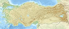
| Location | Asarlık, Nallıhan, Ankara Province, Turkey |
| Coordinates | 40°19′02″N 31°24′50″E / 40.31722°N 31.41389°ECoordinates: 40°19′02″N 31°24′50″E / 40.31722°N 31.41389°E |
| Area | 52.374 hectares (129.42 acres) |
Asarlık Hills (Turkish: Asarlık Tepeler) are hills located in Ankara Province, central Turkey. The area is a registered natural monument of the country.
It is 24 km (15 mi) away from the center of Nallıhan district in Ankara Province, and situated in Asarlık location within the boundaries of Danişment and Uzunöz villages. The area constitutes rare examples of cuesta geomorphology formed by the abrasion of clay layers with different resistances. It covers an area of 52.374 ha (129.42 acres).[1][2][3]
Being of both scientific and visual interest, the area with hills was registered a natural monument on August 22, 1994.[1][2]
References[]
- ^ a b "Ankara Asarlık Tepeler Tabiat Anıt Kaydı" (in Turkish). Orman ve Su İşleri Bakanlığı 9. Bölge Müdürlüğü. Retrieved 2017-01-17.
- ^ a b "Kültürel Zenginlikler" (in Turkish). Nallıhan Belediyesi. Retrieved 2017-01-17.
- ^ "Türkiye'nin Tabiat Anıtları" (PDF) (in Turkish). Milli Parklar. Archived from the original (PDF) on 2016-04-20. Retrieved 2017-01-17.
| Caves | |
|---|---|
| Forests | |
| Landforms | |
| Trees | |
| Waterfalls | |
This protected areas-related article is a stub. You can help Wikipedia by . |
Categories:
- Hills of Turkey
- Natural monuments of Turkey
- Landforms of Ankara Province
- Nallıhan
- Protected areas established in 1994
- 1994 establishments in Turkey
- Nallıhan geography stubs
- Protected area stubs