Ashrafpur, Singhpur, Raebareli
Ashrafpur | |
|---|---|
Village | |
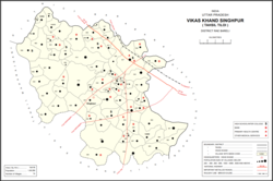 Map showing Ashrafpur (#012) in Singhpur CD block | |
 Ashrafpur Location in Uttar Pradesh, India | |
| Coordinates: 26°33′20″N 81°27′36″E / 26.555568°N 81.460093°ECoordinates: 26°33′20″N 81°27′36″E / 26.555568°N 81.460093°E[1] | |
| Country India | |
| State | Uttar Pradesh |
| District | Raebareli |
| Area | |
| • Total | 1.843 km2 (0.712 sq mi) |
| Population (2011)[2] | |
| • Total | 1,373 |
| • Density | 740/km2 (1,900/sq mi) |
| Languages | |
| • Official | Hindi |
| Time zone | UTC+5:30 (IST) |
| PIN | 229308[2] |
| Vehicle registration | UP-35 |

Ashrafpur is a village in Singhpur block of Rae Bareli district, Uttar Pradesh, India.[2] As of 2011, its population is 1,373, in 262 households.[2] It has no schools and no healthcare facilities.[2]
The 1961 census recorded Ashrafpur (here spelled "Asrafpur") as comprising 2 hamlets, with a total population of 432 people (221 male and 211 female), in 124 households and 119 physical houses.[3] The area of the village was given as 309 acres.[3]
The 1981 census recorded Ashrafpur as having a population of 595 people, in 129 households, and having an area of 138.00 hectares.[4]
References[]
- ^ Do a radial search using these coordinates here https://geonames.nga.mil/namesgaz/.
{{cite web}}: Missing or empty|title=(help) - ^ a b c d e f "Census of India 2011: Uttar Pradesh District Census Handbook - Rae Bareli, Part A (Village and Town Directory)" (PDF). Census 2011 India. pp. 125–41. Retrieved 28 July 2021.
- ^ a b Census 1961: District Census Handbook, Uttar Pradesh (39 - Raebareli District) (PDF). Lucknow. 1965. pp. xviii-xix of section "Maharajganj Tahsil". Retrieved 29 July 2021.
- ^ Census 1981 Uttar Pradesh: District Census Handbook Part XIII-A: Village & Town Directory, District Rae Bareli (PDF). 1982. pp. 46–7. Retrieved 29 July 2021.
This Raebareli district location article is a stub. You can help Wikipedia by . |
Categories:
- Villages in Raebareli district
- Lucknow division geography stubs