Assa (river)
| Assa | |
|---|---|
 The Assa valley | |
 | |
| Location | |
| Countries | Georgia and Russia |
| Physical characteristics | |
| Mouth | Sunzha |
• coordinates | 43°15′17″N 45°24′51″E / 43.25472°N 45.41417°ECoordinates: 43°15′17″N 45°24′51″E / 43.25472°N 45.41417°E |
| Length | 133 km (83 mi)[1] |
| Basin size | 2,060 km2 (800 sq mi)[1] |
| Basin features | |
| Progression | Sunzha→ Terek→ Caspian Sea |


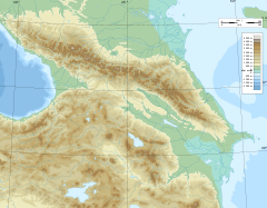

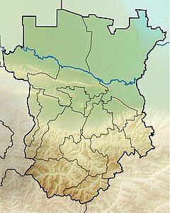
The Assa (Tsirtslovn-Tskhali, Russian: Асса, Цирцловн-Цхали, Georgian: ასა, Chechen: Iaьса-хи, Ingush: Эса-хий) is a right tributary of the Sunzha in Georgia and Russia. It is located in Dusheti Municipality of Mtskheta-Mtianeti, Georgia; and in Dzheyrakhsky and Sunzhensky Districts of Ingushetia and in Sunzhensky and Achkhoy-Martanovsky Districts of Chechnya, Russia.[2]
Geography[]
It measures 133 kilometres (83 mi) long, and incorporates a drainage basin which is 2,060 square kilometres (800 sq mi).[1] The basin includes the major part of Ingushetia, areas in the west of Chechnya, as well as minor areas in the north of Georgia. Within the river basin, more than 70% of the territory is subjected to avalanches.[3]
The river's source is on the northern slopes of the Greater Caucasus in Khevsureti from where it flows north and crosses into Russia. The Assa accepts the from the right and flows through the Erzi Nature Reserve. North of the stanitsa of Nesterovskaya, the Assa turns east, crosses into Chechnya, flows through the stanitsa of Assinovskaya, and accepts the Fortanga from the right. The mouth of the Assa is at the locality of Zakan-Yurt. The principal tributary of the Assa is the (right).
The Assa and Terek also flow through the Republic of Ingushetia in a south to north direction. The Assa, Terek and Gulaykhi river valleys are known for their large complex of stone battle towers and dwellings, burial crypts, pagan sanctuaries, and Christian churches". The Ingushes culture of the North Caucasus, one of the ancient cultures, is well preserved here by the Dzhairakha-Assa state historical and architectural museum.[4] The village of is situated on the river's left bank,[5] while the rural locality of Samashki is located on the river's outskirts.[6] The village of is split in two by the river; Lower Alkun is inhabited by Ingush, while Upper Alkun is inhabited by .[7]
The climate in the river valley is characterized as having a frequent drying effect which supports special microzones.[8]
History[]
In the Middle Ages, a mine was located on the right bank, measuring 1 kilometre (0.6 mi) in length and 200 to 250 metres (660 to 820 ft) in width. Finds included an iron bar and working of native gold.[9]
Though construction of a railway tunnel was envisaged from Georgia to Russia in the 1980s, including passage through the Assa River valley, construction was suspended a decade later.[8]
Reservation[]
The upper reaches of the Assa and the Armhi have been combined into a natural reservation called the Jeyrakh-Assa museum-reserve, which has canyon valleys. Its historical importance is due to the medieval Christian Temple of 12th century and several other structures of Bronze Age (9th through 6th centuries BC), 300 towers of the 16th and 17th centuries which are habitable and where battles were fought, and 18 human habitats including 200 vaults dated to the same era. For these historical reasons, the Jeyrakh-Assa Reservation has been proposed to be inscribed as a UNESCO World Heritage Site.[10]
See also[]
References[]
- ^ a b c "Река Асса (Цирцловн-Цхали)" (in Russian). State Water Register of Russia. Retrieved 25 April 2013.
- ^ Human Rights Watch. Human Rights Watch/ RUSSIA. Human Rights Watch. p. 38. GGKEY:3NG341HY0X5. Retrieved 25 April 2013.
- ^ Vogtmann, Hartmut; Dobretsov, Nikolai (26 April 2006). Environmental Security and Sustainable Land Use - with Special Reference to Central Asia. Springer. pp. 163–. ISBN 978-1-4020-4492-2. Retrieved 28 April 2013.
- ^ "The Russian Embassy in Belgium invite you to assist at: Official presentation of the Economic potential of the Republic of Ingushetia by H.E. the President of the Ingush republic Y.B. Evkurov". Brussels: Centre Culturel et Scientifique de Russie. November 23, 2012. Archived from the original on April 17, 2016. Retrieved April 29, 2013.
- ^ The Mammals of the Caucasus: A History of the Evolution of the Fauna. (Mlekopitayushchie Kavkaza; Istoriya Formirovaniya Fauny) (Available from the U.S. Department of Commerce, Clearinghouse for Federal Scientific and Technical Information, Springfield, Va. ed.). Israel Program for Scientific Translations. 1967. p. 184. Retrieved 28 April 2013.
- ^ Goltz, Thomas (10 October 2003). Chechnya Diary: A War Correspondent's Story of Surviving the War in Chechnya. Macmillan. pp. 115–. ISBN 978-1-4299-7435-6. Retrieved 28 April 2013.
- ^ Gammer, Moše (22 October 2007). Ethno-Nationalism, Islam and the State in the Caucasus: Post-Soviet Disorder. Routledge. pp. 142–. ISBN 978-1-134-09853-8. Retrieved 28 April 2013.
- ^ a b Price, Martin F. (2000). Cooperation in the European Mountains: The Caucasus. IUCN. pp. 111–. ISBN 978-2-8317-0534-7. Retrieved 28 April 2013.
- ^ Blanchard, Ian (2001). Mining, Metallurgy and Minting in the Middle Ages: Asiatic Supremacy, 425-1125. Franz Steiner Verlag. pp. 109, 249–. ISBN 978-3-515-07958-7. Retrieved 28 April 2013.
- ^ "Historical and Cultural Jeyrakh-Assa Reservation". UNESCO Organization. Retrieved 29 April 2013.
- Tributaries of the Terek
- Rivers of Chechnya
- Rivers of Ingushetia
- Rivers of Georgia (country)
- International rivers of Asia
- International rivers of Europe