Astove Island Airport
Astove Island Airport | |||||||||||
|---|---|---|---|---|---|---|---|---|---|---|---|
| Summary | |||||||||||
| Airport type | Public | ||||||||||
| Serves | Astove Island | ||||||||||
| Elevation AMSL | 10 ft / 3 m | ||||||||||
| Coordinates | 10°03′40″S 47°45′00″E / 10.06111°S 47.75000°ECoordinates: 10°03′40″S 47°45′00″E / 10.06111°S 47.75000°E | ||||||||||
| Map | |||||||||||
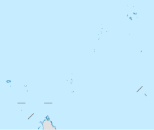 FSSA Location of the airport in Seychelles | |||||||||||
| Runways | |||||||||||
| |||||||||||
Astove Island Airport (ICAO: FSSA) is an airstrip serving Astove Island in Seychelles. The island is 1,040 kilometres (650 mi) southwest of the Seychelles capital of Victoria on Mahé Island.
See also[]
 Aviation portal
- List of airports in Seychelles
- Transport in Seychelles
References[]
- ^ Airport information for FSSA at Great Circle Mapper.
- ^ Google Maps - Astove Island
External links[]
This article about an airport in Seychelles is a stub. You can help Wikipedia by . |
This Seychelles-related article is a stub. You can help Wikipedia by . |
Categories:
- Airports in Seychelles
- Southern African airport stubs
- Seychelles stubs