Athurugiriya
Athurugiriya
අතුරුගිරිය அத்துருகிரிய | |
|---|---|
| Motto(s): | |
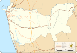 Athurugiriya Location of Athurugiriya in Colombo District | |
| Coordinates: 6°53′32″N 79°56′34″E / 6.89222°N 79.94278°ECoordinates: 6°53′32″N 79°56′34″E / 6.89222°N 79.94278°E | |
| Country | Sri Lanka |
| Province | Western Province |
| District | Colombo District |
| Elevation | 30 m (100 ft) |
| Population | |
| • Suburb | 84,278 |
| • Urban | 5,799 |
| • Metro | 78,479 |
| Time zone | UTC+5:30 (SLT) |
| Postal Code | 10150 [1] |

Athurugiriya is a suburb of Colombo in Colombo District, Sri Lanka. It is situated on the Kotte-Bope Road (B 240) about 15 km (9.3 mi) away from the centre of the commercial capital Colombo. This suburb is a highly sought after residential centre in Colombo.
History[]
History of the area dates back to at least 212 BC. The historic cave temple complex, Korathota Raja Maha Vihara, is located 3 km (1.9 mi) north from the city centre. Brahmi inscriptions on the cave temple mention a dedication from the daughter of King Walagamba and a local official.
This temple has two important historical inscriptions, which says this temple was offer to Maha Sanga by a daughter of Mahachula Mahatissa. Second one says one cave offered to Maha Sanga by a provincial leader call Sumana.[2]
Transport[]
Athurugiriya has one of the interchanges of Outer Circular Expressway, which is located at , about 1 km (0.62 mi) from Colombo centre.
Athurugiriya is a major urban centre located along the road connecting Malabe on , and Godagama on High Level Road. In addition, Kaduwela and Thalawathugoda are major urban centres nearby.
Residential[]
Athurugiriya is a highly sought after residential area in Colombo. Many important government office complexes; such as , , and many other government institutions in ; are situated within 10 km (6.2 mi) of Athurugiriya.
Upper-middle class housing complex is located within 1 km (0.62 mi) from Athurugiriya.
See also[]
References[]
- Populated places in Colombo District
- Suburbs of Colombo