Attapeu
Attapeu
ອັດຕະປື | |
|---|---|
| Samakkhixay District | |
 | |
 Attapeu Location in Laos | |
| Coordinates: 14°49′12″N 106°49′14″E / 14.82000°N 106.82056°E | |
| Country | Laos |
| Admin. division | Attapeu Province |
| Founded | 1560 |
| Elevation | 93 m (305 ft) |
| Population (2005) | |
| • Total | 19,200 |
| • Religions | Buddhism |
| Time zone | UTC+7 (ICT) |

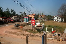
Attapeu (Lao: ອັດຕະປື), also written as Attopu or Attapu, is the capital of Attapeu Province, Laos. Its official name is Muang Samakhi Xay. It is the southernmost of provincial capitals in Laos.
Most of the inhabitants are Lao Loum. The temple of Wat Luang Muang Mai in the town centre was built in 1939 and is notable for original naga barge boards.[1] A monument dedicated to Kaysone Phomvihane was erected near the temple.
Transport[]
Attapeu International Airport is about 28 kilometres (17 mi) from Attapeu.[2] The airport opened in May 2015 but did not receive flights until April 2016, when Lao Airlines introduced flights from Vientiane via Pakse.[3] However, the airline withdrew from the market in October 2016 due to low demand.[4] TTR Weekly attributed the airport's condition to the lack of nearby tourist attractions, even though commercial activity has risen due to Attapeu's proximity to Vietnam.[5]
See also[]
References[]
- ^ Bush, Elliot & Ray, p. 308.
- ^ Latsaphao, Khonesavanh (18 October 2016). "Attapeu airport potential examined during PM's visit". Vientiane Times. Retrieved 15 January 2017.
- ^ "Vientiane–Attapeu flights starting to takeoff". Vientiane Times. 5 October 2016. Retrieved 15 January 2017.
- ^ "Vientiane–Attapeu flights' wings clipped". Vientiane Times. 11 January 2017. Retrieved 15 January 2017.
- ^ Ngamsangchaikit, Wanwisa (15 June 2015). "No services to Attapeu airport". TTR Weekly. Archived from the original on 17 August 2017. Retrieved 15 January 2017.
- Populated places in Attapeu Province
- Provincial capitals in Laos
- Populated places established in 1560