Aurach (Regnitz, Mittelfranken)
- There exists also another river named Aurach that is a tributary of the Regnitz, see Aurach (Regnitz, Oberfranken). For other uses, see Aurach (disambiguation).
show This article may be expanded with text translated from the corresponding article in German. (September 2011) Click [show] for important translation instructions. |
| Aurach | |
|---|---|
 | |
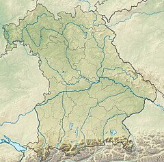 Location of mouth in Bavaria | |
| Location | |
| Country | Germany |
| State | Bavaria |
| Physical characteristics | |
| Mouth | |
• location | Regnitz |
• coordinates | 49°34′16″N 10°59′00″E / 49.5712°N 10.9834°ECoordinates: 49°34′16″N 10°59′00″E / 49.5712°N 10.9834°E |
| Length | 39.3 km (24.4 mi) [1] |
| Basin size | 165 km2 (64 sq mi) [1] |
| Basin features | |
| Progression | Regnitz→ Main→ Rhine→ North Sea |

Aurach (German pronunciation: [ˈaʊ̯ʁax] (![]() listen); also: Mittlere Aurach) is a river of Bavaria, Germany. It is a tributary of the river Regnitz.
listen); also: Mittlere Aurach) is a river of Bavaria, Germany. It is a tributary of the river Regnitz.
The river Aurach begins in the Franconian Heights to the west of the village Klausaurach in the municipality of Markt Erlbach. It runs through Aurachtal, the town of Herzogenaurach, and the Erlangen district of . After crossing under the Main-Danube Canal, it joins the river Regnitz at the Erlangen district of .
A recreational cycle path runs alongside the river Aurach from Herzogenaurach to Erlangen.
See also[]
References[]
- ^ Jump up to: a b Complete table of the Bavarian Waterbody Register by the Bavarian State Office for the Environment (xls, 10.3 MB)
| Authority control |
|---|
Categories:
- Tributaries of the Regnitz
- Rivers of Bavaria
- Rivers of Germany
- Bavaria river stubs