Avanhandava
Avanhandava | |
|---|---|
 Flag  Coat of arms | |
 Location in São Paulo state | |
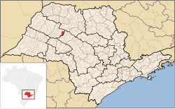
 Avanhandava Location in Brazil | |
| Coordinates: 21°27′39″S 49°56′59″W / 21.46083°S 49.94972°WCoordinates: 21°27′39″S 49°56′59″W / 21.46083°S 49.94972°W | |
| Country | Brazil |
| Region | Southeast |
| State | São Paulo |
| Area | |
| • Total | 338 km2 (131 sq mi) |
| Population (2020 [1]) | |
| • Total | 13,859 |
| • Density | 41/km2 (110/sq mi) |
| Time zone | UTC-03:00 (BRT) |
| • Summer (DST) | UTC-02:00 (BRST) |

Avanhandava is a municipality in the state of São Paulo in Brazil. The population is 13,859 (2020 est.) in an area of 338 km².[2] The elevation is 428 m.
References[]
This geographical article relating to the state of São Paulo is a stub. You can help Wikipedia by . |
Categories:
- São Paulo (state) geography stubs
- Municipalities in São Paulo (state)