Avera, Raiatea
Avera | |
|---|---|
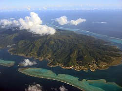
 Raiatea, the island on which Avera is located. | |
| Coordinates: 16°47′52″S 151°24′4″W / 16.79778°S 151.40111°WCoordinates: 16°47′52″S 151°24′4″W / 16.79778°S 151.40111°W | |
| Country | French Polynesia |
| Island | Raiatea |
| Commune | Taputapuatea |
| Elevation | 15 m (49 ft) |
| Population (2017 census) | 3,265 |
| Time zone | |
| Tahiti Time[2] | UTC-10:00 (TAHT) |
Avera is an associated commune on the island of Raiatea, in French Polynesia. It is the larger of two villages in French Polynesia with this name, the other being located on the island of Rurutu. It is part of the commune Taputapuatea. According to the 2017 census, it had grown to a population 3,265 people.[3]
References[]
- ^ "Avera, Raiatea, French Polynesia". elevationmap.net. Archived from the original on April 30, 2018. Retrieved 2019-01-25.
- ^ "Time Zone & Clock Changes in Avera, French Polynesia". timeanddate.com. Retrieved 7 May 2020.
- ^ "French Polynesia". Archived from the original on April 30, 2018. Retrieved 2019-01-25.
Categories:
- French Polynesia geography stubs
- Raiatea
- Populated places in the Society Islands
