Axel, Netherlands
Axel | |
|---|---|
Town | |
 Flag  Coat of arms | |
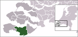 | |
 The town centre (dark green) and the statistical district (light green) of Axel in the municipality of Terneuzen. | |
| Coordinates: 51°15′56″N 3°54′32″E / 51.26556°N 3.90889°ECoordinates: 51°15′56″N 3°54′32″E / 51.26556°N 3.90889°E | |
| Country | Netherlands |
| Province | Zeeland |
| Municipality | Terneuzen |
| Population (31-12-2009) | |
| • Total | 7,923 |
| Time zone | UTC+1 (CET) |
| • Summer (DST) | UTC+2 (CEST) |

Axel is a town in the southwest Netherlands. It is located in the municipality of Terneuzen, Zeeland, about 31 km southeast of Vlissingen.
In 2001, the town of Axel had 7,421 inhabitants. The built-up area of the town is 1.9 km2 (0.73 sq mi), and contains 3,408 residences.[1] The statistical area "Axel", which also can include the surrounding countryside, has a population of around 8,190.[2]
History[]
Axel received city rights in 1213.
A railroad, connecting Terneuzen and Sint-Niklaas, once ran through the city.
Until 2003, Axel was a separate municipality.
References[]
- ^ Statistics Netherlands (CBS), Bevolkingskernen in Nederland 2001. (Statistics are for the continuous built-up area).
- ^ Statistics Netherlands (CBS), Statline: Kerncijfers wijken en buurten 2003-2005 Archived 1999-04-27 at the Wayback Machine. As of 1 January 2005.
External links[]
| Wikimedia Commons has media related to Axel. |
- J. Kuyper, Gemeente Atlas van Nederland, 1865-1870, "Axel". Map of the former municipality in 1868.
- Mayors of Axel 1581 - 1800
- Aldermen of Axel 1492 - 1746
| hide Authority control | |
|---|---|
| General |
|
| National libraries | |
This article about a location in Zeeland is a stub. You can help Wikipedia by . |
Categories:
- Former municipalities of Zeeland
- Populated places in Zeeland
- Terneuzen
- Zeeland geography stubs