az-Za'ayyem
az-Za'ayyem | |
|---|---|
Municipality type D (Village council) | |
| Arabic transcription(s) | |
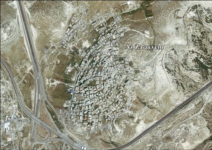
 Az-Za'ayyem and Az-Za'ayyem checkpoint, from the air | |
 az-Za'ayyem Location of az-Za'ayyem within Palestine | |
| Coordinates: 31°47′16.41″N 35°15′54.11″E / 31.7878917°N 35.2650306°ECoordinates: 31°47′16.41″N 35°15′54.11″E / 31.7878917°N 35.2650306°E | |
| State | State of Palestine |
| Governorate | Jerusalem |
| Government | |
| • Type | Village council |
| Population (2006) | |
| • Total | 2,459 |

az-Za'ayyem (Arabic: الزعیم) is a Palestinian village in the Jerusalem Governorate, located 3 kilometers east of Jerusalem in the central West Bank. According to the Palestinian Central Bureau of Statistics, the village had a population of 2,459 in 2006.[1] The healthcare facilities for az-Za'ayyem according to the Ministry of Health are obtained in East Jerusalem.[2]
History[]
1967, aftermath[]
After the 1967 Six-Day War, az-Za'ayyem has been under Israeli occupation.
After the 1995 accords, 3.8% (or 236 dunams) of the land was classified as Area B, the remaining 96.2% (or 5,896 dunams) as Area C.[3]
Israel has confiscated land from az-Za'ayyem in order to construct two Israeli settlements:
- 406 dunams for Ma’ale Adumim,[3]
- 138 dunams for Mishor Adumim (industrial zone).[3]
az-Za'ayyem lies close to Highway 1 to Jerusalem and the az-Za'ayyem check point in the separation barrier.[4][5][6][7]
References[]
- ^ Projected Mid -Year Population for Jerusalem Governorate by Locality 2004- 2006 Archived February 7, 2012, at the Wayback Machine Palestinian Central Bureau of Statistics.
- ^ Health care Facilities West Bank
- ^ a b c Az Za'ayyem Village Profile, ARIJ, p. 16
- ^ Humanitarian Events, Monitoring issues Archived 2005-11-12 at the Wayback Machine
- ^ "Barrier March 2004" (PDF). Archived from the original (PDF) on 2009-10-13. Retrieved 2008-07-16.
- ^ Displaced by the Wall: Pilot Study on Forced Displacement Caused by the Construction of the West Bank Wall and its Associated Regime in the Occupied Palestinian territories (PDF) (Report). BADIL. 2006. Retrieved 2018-11-09.
- ^ "Barrier route July 2008" (PDF). Archived from the original (PDF) on 2008-09-10. Retrieved 2008-07-16.
External links[]
- Az Za'ayyem Village (Fact Sheet), Applied Research Institute–Jerusalem ARIJ
- Az Za'ayyem Village Profile, ARIJ
- Aerial photo, ARIJ
- Locality Development Priorities and Needs in Az Za'ayyem, ARIJ
Jerusalem Governorate | ||
|---|---|---|
| Subdistrict | Jerusalem J1 (Territories of East Jerusalem unilaterally annexed by Israel in its Jerusalem Municipality) |  |
| Cities | ||
| Municipalities | ||
| Villages | ||
| Refugee camps |
| |
This geography of the State of Palestine article is a stub. You can help Wikipedia by . |
- Jerusalem Governorate
- Villages in the West Bank
- Municipalities of the State of Palestine
- Palestine geography stubs